1. Delhi Metro (DMRC)
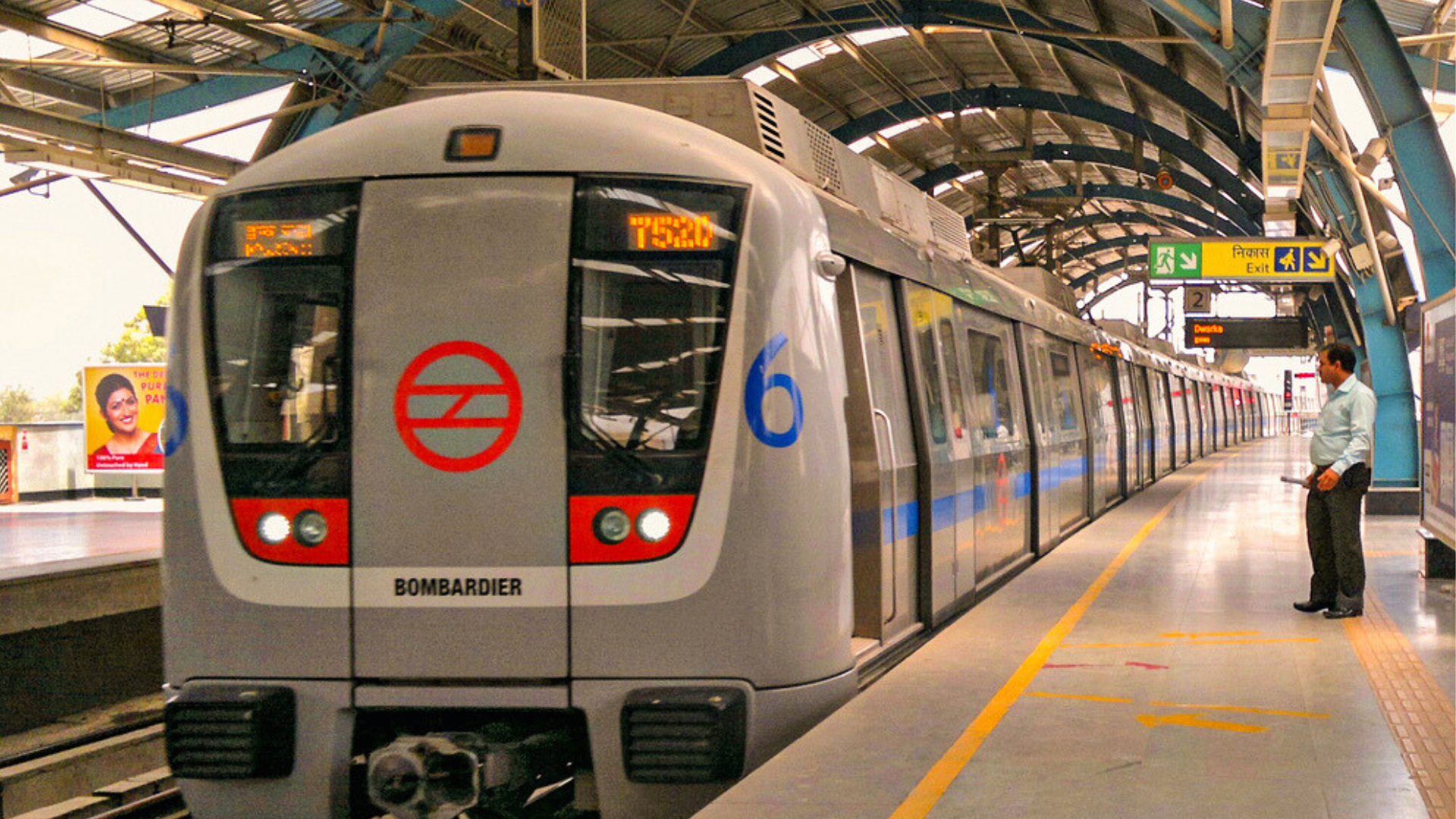
The Delhi Metro is a key component of Delhi’s public transportation system, known for its efficiency and extensive coverage. Here’s a detailed overview:
1. History and Development
- Inception: The Delhi Metro project was initiated in the early 1990s to address the growing traffic congestion in the city. The first phase began construction in 1998.
- Opening: The first line, the Red Line (Shaheed Sthal to Rithala), was inaugurated on December 25, 2002.
2. Network and Lines
- Lines: The Delhi Metro network consists of multiple lines, each identified by different colors. As of 2024, there are 12 lines in operation, with ongoing expansions. The major lines include:
- Red Line (Line 1): Shaheed Sthal to Rithala
- Yellow Line (Line 2): Samaypur Badli to HUDA City Centre
- Blue Line (Line 3/4): Dwarka Sector 21 to Noida City Centre/Vaishali
- Green Line (Line 5): Inderlok to Brigadier Hoshiyar Singh
- Pink Line (Line 7/9): Majlis Park to Shiv Vihar
- Magenta Line (Line 8): Janakpuri West to Botanical Garden
- Aqua Line (Line 9): Noida City Centre to Sector 62
- Airport Express Line: New Delhi Station to Dwarka Sector 21
3. Features
- Stations: The network includes over 300 stations, with modern amenities like escalators, elevators, and automated ticket vending machines.
- Trains: The trains are air-conditioned and equipped with safety features. They run on elevated tracks, underground, and at-grade sections.
- Frequency: Trains typically run every 2-5 minutes during peak hours, depending on the line.
4. Expansion and Future Plans
- Ongoing Projects: The Delhi Metro is continuously expanding. New lines and extensions are under construction to connect more areas of the National Capital Region (NCR) and improve connectivity.
- Future Lines: Upcoming phases include the Silver Line, connecting Delhi to the eastern parts of NCR, and the Extension of existing lines like the Pink and Magenta Lines.
5. Ticketing and Fare Structure
- Ticketing: Tickets are available at stations, and there’s also a smart card system called the Delhi Metro Card, which offers convenience and discounts.
- Fare Structure: Fares are distance-based and are designed to be affordable. Different types of cards and passes are available for daily, monthly, or yearly use.
6. Impact and Significance
- Traffic Decongestion: The Metro has significantly reduced road traffic congestion and pollution in Delhi.
- Economic Benefits: It has spurred economic growth by improving accessibility to different parts of the city and its suburbs.
- Social Impact: The Metro system has made commuting safer, faster, and more reliable, contributing to a higher quality of life for Delhi’s residents.
7. Safety and Efficiency
- Safety: The Delhi Metro is equipped with advanced safety systems, including surveillance cameras, fire detection, and emergency communication systems.
- Efficiency: Known for its punctuality and high operational standards, it has become a model for other cities in India and beyond.
The Delhi Metro continues to be a vital part of Delhi’s urban landscape, transforming how people travel and contributing to the city’s modernization.
2. Bengaluru Metro (BMRCL)
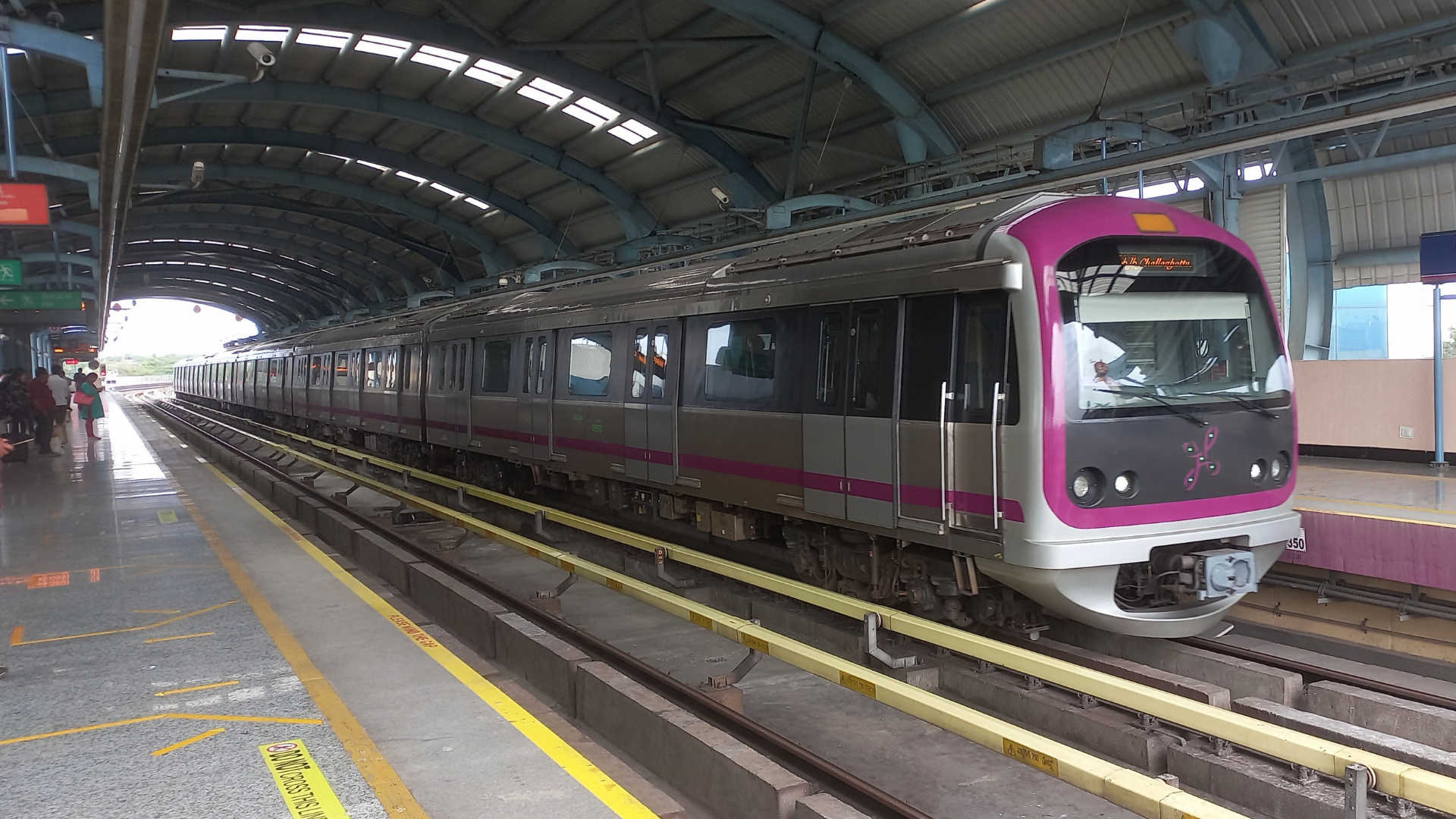
The Bengaluru Metro, officially known as Namma Metro, is a significant part of Bangalore’s (Bengaluru’s) public transportation system. It’s designed to alleviate the city’s traffic congestion and provide a reliable and efficient mode of travel. Here’s a detailed overview:
History and Development
- Initiation: The concept of a metro system in Bangalore was first proposed in the early 1990s, with feasibility studies conducted to address the growing traffic issues.
- Construction: Construction of the Namma Metro began in 2006, with the aim of modernizing the city’s transportation infrastructure and reducing traffic congestion.
- Opening: The first section of the metro, which is part of the Purple Line, was inaugurated on October 20, 2011.
Network and Lines
The Namma Metro network is divided into several lines, each serving different parts of the city and its suburbs. The main lines are:
Purple Line:
- Route: Baiyappanahalli to Mysuru Road
- Length: Approximately 25.6 km
- Highlights: Connects key areas such as MG Road, and KR Market, and integrates with the Green Line.
Green Line:
- Route: Nagasandra to Yelachenahalli
- Length: Approximately 24.2 km
- Highlights: Connects the northern and southern parts of the city, passing through important locations like Sampige Road and Jayanagar.
Yellow Line:
- Route: Byappanahalli to Whitefield (Kadugodi)
- Length: Approximately 15.5 km (under construction/phase)
- Highlights: Designed to serve the IT and business hubs in the eastern part of the city.
Pink Line:
- Route: The line is currently under construction, extending from Silk Board to KR Puram.
Blue Line (Under Construction):
- Route: Estimated to connect the southern parts of the city with the eastern suburbs.
Features and Technology
- Stations: The metro stations are equipped with modern facilities such as escalators, elevators, automated ticket vending machines, and electronic information boards. Stations are designed to be user-friendly and accessible to all passengers.
- Trains: The trains are air-conditioned and designed for comfort and efficiency. They are equipped with safety features, including CCTV surveillance and fire alarms.
- Ticketing: Namma Metro uses a smart card system called the “Namma Metro Card” which provides ease of travel and convenience. Tickets can also be purchased at stations.
Expansion and Future Plans
- Ongoing Projects: Namma Metro is undergoing significant expansion to cover more areas and improve connectivity. New lines and extensions are planned to enhance reach and service.
- Future Lines:
- RERA (Regulation and Development) Line: The extension from Nagavara to Gottigere is expected to further enhance connectivity.
- Blue Line: The line connecting KR Puram to Whitefield will improve access to the IT and business districts.
- Yellow Line Extension: Plans are underway to extend the line further into the eastern suburbs.
Economic and Social Impact
- Traffic Decongestion: The Namma Metro has alleviated traffic congestion in Bengaluru, offering a reliable alternative to road transport.
- Economic Benefits: By improving connectivity, the metro has boosted economic activities, particularly in IT and business districts. It has also facilitated access to commercial and residential areas.
- Improved Quality of Life: The metro has made daily commuting more efficient and comfortable, contributing to a better quality of life for Bengaluru’s residents.
Safety and Efficiency
- Safety Measures: The Namma Metro is equipped with various safety features, including advanced fire detection systems, emergency communication facilities, and regular maintenance checks.
- Operational Efficiency: The metro operates with high punctuality and efficiency, adhering to international standards of urban transit.
Conclusion
Namma Metro is a testament to Bengaluru’s ambition to modernize its public transportation system and address urban mobility challenges. It has transformed the cityscape, providing residents with a fast, reliable, and eco-friendly mode of travel. With ongoing expansions and future developments, the Bengaluru Metro is set to play a crucial role in shaping the city’s transportation future, making it an essential part of Bengaluru’s urban infrastructure.

3. Hyderabad Metro (HMRL)
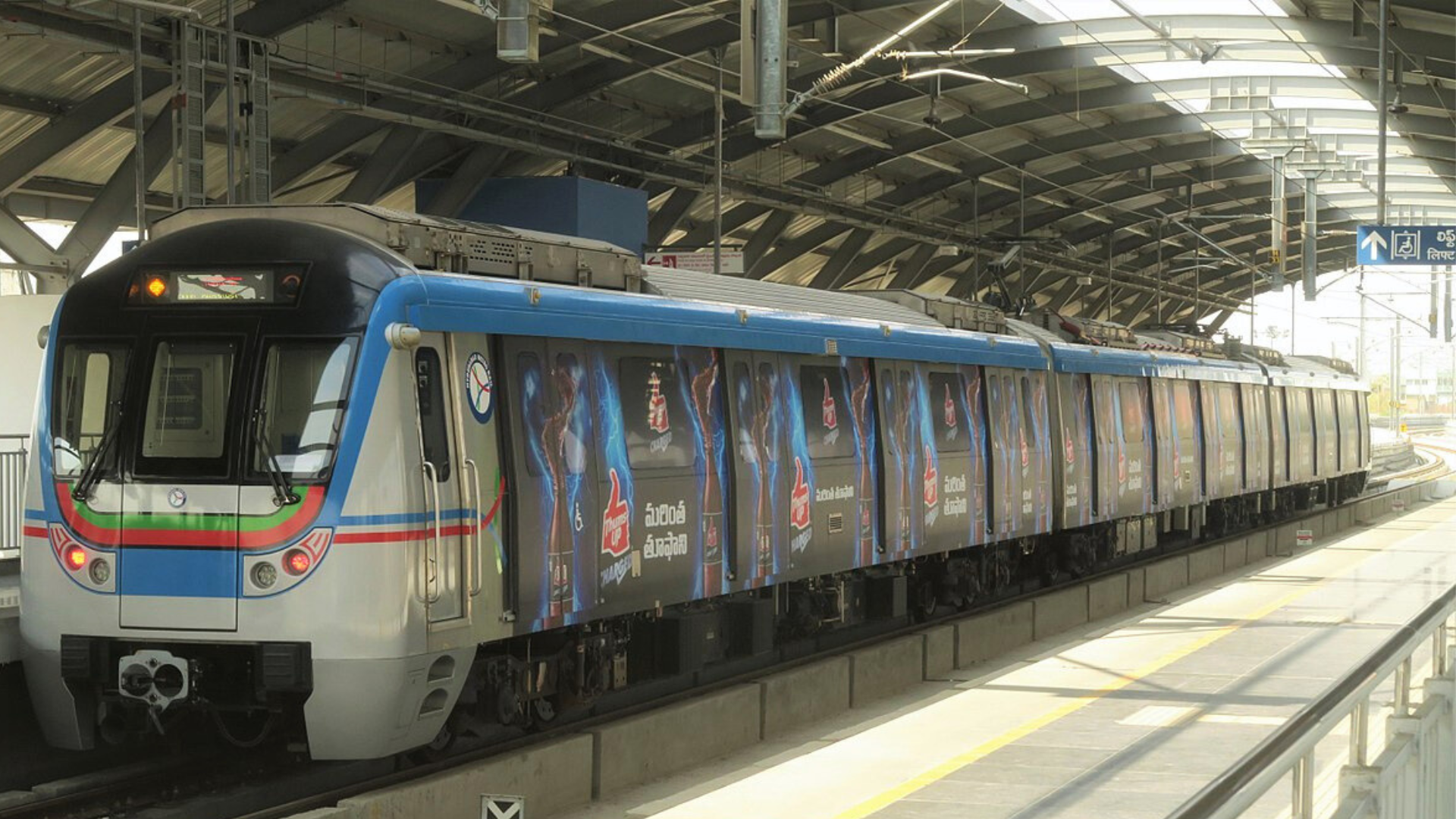
The Hyderabad Metro, officially known as the Hyderabad Metro Rail (HMR), is a significant urban transit system designed to improve connectivity and reduce traffic congestion in Hyderabad, Telangana. Here’s a detailed look at the Hyderabad Metro:
History and Development
- Initiation: The idea for a metro system in Hyderabad emerged in the early 2000s to address the city’s rapid urbanization and growing traffic issues. The project was approved in 2010.
- Construction: The Hyderabad Metro Rail project was developed under a public-private partnership (PPP) model, with the L&T Metro Rail Hyderabad (L&TMRHL) consortium undertaking construction.
- Opening: The first section of the metro, part of the Blue Line, began operations on November 29, 2017.
Network and Lines
The Hyderabad Metro network is divided into several lines, each serving different parts of the city:
Blue Line (Line 1):
- Route: Nagole to Raidurg
- Length: Approximately 29.2 km
- Highlights: This line connects important areas like MG Road, Parade Ground, and Hitec City, serving the central and IT hubs of the city.
Red Line (Line 2):
- Route: JBS Parade Ground to MG Bus Station
- Length: Approximately 15.5 km
- Highlights: This line connects key areas such as Secunderabad, Parade Ground, and MG Bus Station, providing a crucial north-south corridor.
Green Line (Line 3):
- Route: Nagole to Shilparamam
- Length: Approximately 27.5 km
- Highlights: Serving the eastern parts of Hyderabad, this line includes areas like Uppal, Mettuguda, and Kukatpally.
Features and Technology
- Stations: The Hyderabad Metro stations are designed with modern amenities such as escalators, elevators, and automated ticket vending machines. Stations are equipped with amenities for passengers’ convenience and safety.
- Trains: The metro trains are air-conditioned and designed for comfort, with features like real-time information displays and safety mechanisms.
- Ticketing: The metro uses a smart card system known as the “HMR Card,” which facilitates easy and efficient travel. Tickets can also be purchased at station counters and vending machines.
Expansion and Future Plans
- Ongoing Projects: Several extensions and new lines are under construction to enhance connectivity across the city. Key projects include:
- Extension of the Blue Line: Extending to Raidurg and other critical areas.
- Expansion of the Red Line: Connecting more parts of the city and extending to key locations.
- New Lines: Plans for new lines and extensions are ongoing, including connections to outer areas and important business districts.
Economic and Social Impact
- Traffic Decongestion: The Hyderabad Metro has helped alleviate traffic congestion in the city by providing a reliable alternative to road transport.
- Economic Growth: Improved connectivity has spurred economic development, particularly in IT and business hubs, and has facilitated easier access to various commercial and residential areas.
- Quality of Life: The metro system has made commuting more efficient and comfortable, contributing to a higher quality of life for Hyderabad’s residents.
Safety and Efficiency
- Safety Measures: The Hyderabad Metro is equipped with advanced safety systems, including fire detection and alarm systems, surveillance cameras, and emergency communication facilities.
- Operational Efficiency: Known for its punctuality and high operational standards, the metro ensures smooth and reliable service for daily commuters.
Conclusion
The Hyderabad Metro represents a significant achievement in urban transportation for Hyderabad. It has transformed the way residents commute, offering a modern, efficient, and eco-friendly alternative to road transport. With ongoing expansions and future developments, the Hyderabad Metro is set to further enhance connectivity, support economic growth, and improve the overall quality of life in the city. As the network continues to grow, it will play an increasingly vital role in shaping Hyderabad’s urban landscape and addressing the challenges of urban mobility.
4. Kolkata Metro (KMRC)
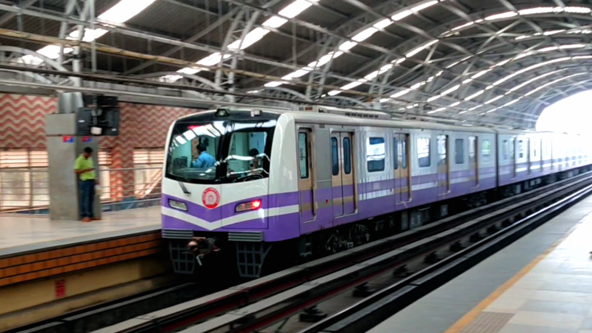
The Kolkata Metro is a pioneering urban transit system in India, known for being the first of its kind in the country. It plays a crucial role in Kolkata’s public transportation network, offering a reliable and efficient mode of travel. Here’s an in-depth look at the Kolkata Metro:
History and Development
- Initiation: The Kolkata Metro project was conceived in the 1960s to address the city’s traffic congestion and provide a modern transport option. Feasibility studies began in the early 1970s.
- Construction: Construction work started in 1972. The project faced various delays due to funding issues, design changes, and logistical challenges.
- Opening: The first section of the metro, running between Esplanade and Bhowanipur, was inaugurated on October 24, 1984. This made Kolkata the first city in India to have a metro system.
Network and Lines
The Kolkata Metro network has evolved over the years and now includes several lines, with further expansions planned:
North-South Line (Line 1):
- Route: Noapara to Kavi Subhash (formerly New Garia)
- Length: Approximately 27.3 km
- Highlights: This is the original line of the Kolkata Metro, connecting the northern and southern parts of the city. It passes through major areas such as Esplanade, Dharmatala, and Park Street.
East-West Line (Line 2):
- Route: Howrah Maidan to Salt Lake Sector V
- Length: Approximately 16.6 km
- Highlights: This line connects Howrah and Salt Lake, crossing through key areas like Esplanade, Sealdah, and Phoolbagan. It integrates with the North-South Line at Esplanade.
North-South Line Extension:
- Extension: The line is being extended from Kavi Subhash to New Garia and eventually to Joka.
- Highlights: This extension aims to improve connectivity in the southern parts of the city.
Line 3 (Purple Line):
- Route: Joka to Esplanade (Under Construction)
- Length: Approximately 16.72 km
- Highlights: The line is expected to enhance connectivity between Joka and Esplanade, serving several important residential and commercial areas.
Line 4 (Yellow Line):
- Route: Bidhan Nagar (Salt Lake) to Phoolbagan (Under Construction)
- Length: Approximately 10.5 km
- Highlights: This line will improve connectivity in the northern and eastern parts of Kolkata, linking with the East-West Line at Phoolbagan.
Line 5 (Blue Line):
- Route: Baranagar to Dakshineswar (Under Construction)
- Length: Approximately 11.5 km
- Highlights: This line is expected to connect areas in the northern suburbs to the central parts of Kolkata.
Features and Technology
- Stations: The metro stations are equipped with modern amenities including escalators, elevators, automated ticket vending machines, and digital information boards. Stations are designed to be accessible and user-friendly.
- Trains: The trains are air-conditioned and feature safety measures such as CCTV surveillance and emergency communication systems.
- Ticketing: The Kolkata Metro uses a smart card system called the “Metro Card,” which allows for convenient and efficient travel. Single journey tickets are also available at stations.
Expansion and Future Plans
- Ongoing Projects: Several extensions and new lines are under development to enhance the network’s coverage and connectivity:
- Extension of Line 1: Extending further south to Joka.
- New Lines: The Kolkata Metro Rail Corporation (KMRC) is working on several new lines and extensions to cover more areas of the city and improve connectivity.
Economic and Social Impact
- Traffic Decongestion: The Kolkata Metro has alleviated traffic congestion in Kolkata, providing a reliable alternative to road transport.
- Economic Development: Improved connectivity has spurred economic activities and facilitated access to key commercial and residential areas.
- Quality of Life: The metro system has made commuting more efficient and comfortable, contributing to a better quality of life for residents.
Safety and Efficiency
- Safety Measures: The Kolkata Metro is equipped with various safety features including fire alarms, surveillance systems, and regular maintenance checks.
- Operational Efficiency: The metro system operates with high punctuality and efficiency, adhering to international standards of urban transit.
Conclusion
The Kolkata Metro stands as a significant achievement in India’s urban transportation history, setting the benchmark for metro systems across the country. With its modern infrastructure and ongoing expansions, the Kolkata Metro continues to transform urban mobility in the city, providing a crucial link between various parts of Kolkata and enhancing the overall commuting experience for its residents. As new lines and extensions are completed, the metro is set to further integrate and improve connectivity across the city, reinforcing its role as a vital component of Kolkata’s urban landscape.

5. Chennai Metro (CMRL)
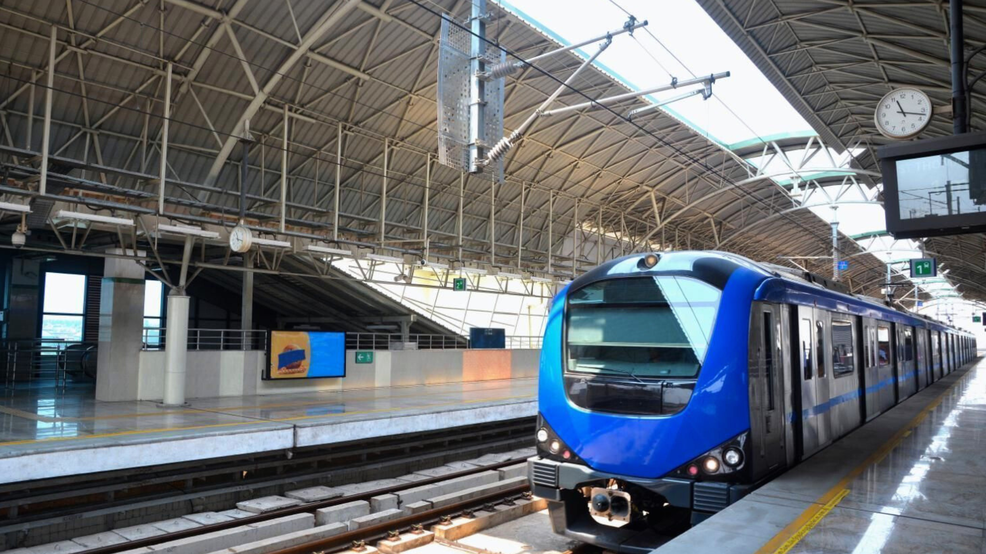
The Chennai Metro is an important urban transit system designed to address traffic congestion and provide a modern, efficient mode of transportation in Chennai, Tamil Nadu. Here’s a comprehensive look at the Chennai Metro:
History and Development
- Initiation: The Chennai Metro project was conceived in the mid-2000s to tackle the increasing traffic congestion and pollution in Chennai. Feasibility studies and planning began in the early 2010s.
- Construction: Construction of the metro began in 2009 under the supervision of the Chennai Metro Rail Limited (CMRL), a joint venture between the Government of India and the Government of Tamil Nadu.
- Opening: The first section of the Chennai Metro, part of the Blue Line (Line 1), was inaugurated on June 29, 2015.
Network and Lines
The Chennai Metro network is designed to cover key areas of the city and is organized into two primary lines, with ongoing expansions:
Blue Line (Line 1):
- Route: Washermenpet to Airport
- Length: Approximately 45.8 km
- Highlights: This line connects northern and southern parts of Chennai, passing through major areas like Central, Egmore, and Koyambedu. It connects the airport to the central business districts and residential areas.
Green Line (Line 2):
- Route: Chennai Central to St. Thomas Mount
- Length: Approximately 26.1 km
- Highlights: This line runs east to west and connects key areas such as Chennai Central, Egmore, and St. Thomas Mount, integrating with Line 1 at the CMBT and the St. Thomas Mount stations.
Expansion and Future Plans
- Ongoing Projects: The Chennai Metro is undergoing significant expansions to enhance coverage and connectivity:
- Phase 1 Extensions: Extensions of Line 1 to North Chennai and additional stations on Line 2 are underway.
- Phase 2: This phase involves constructing new lines and extending existing ones, including:
- Line 3 (Aqua Line): Connecting Madhavaram to SIPCOT, this line will cover approximately 45 km.
- Line 4: Extending from Lighthouse to Poonamallee Bypass.
- Line 5: Connecting from Sholinganallur to CMBT.
- Line 6: Connecting from Saidapet to the airport.
Features and Technology
- Stations: The metro stations are equipped with modern facilities such as escalators, elevators, automated ticket vending machines, and electronic information boards. Stations are designed to be accessible to all passengers.
- Trains: The Chennai Metro trains are air-conditioned and designed for comfort and efficiency. They feature safety systems, real-time information displays, and secure boarding areas.
- Ticketing: The metro uses a smart card system known as the “Chennai Metro Card,” which offers convenience and discounts. Single journey tickets and day passes are also available at stations.
Economic and Social Impact
- Traffic Decongestion: The Chennai Metro helps reduce traffic congestion by providing a reliable and efficient alternative to road transport.
- Economic Growth: Improved connectivity has stimulated economic activities, particularly in key commercial and business districts. It has also facilitated access to various parts of the city.
- Quality of Life: The metro system has made commuting more comfortable and efficient, contributing to a better quality of life for Chennai’s residents.
Safety and Efficiency
- Safety Measures: The Chennai Metro is equipped with advanced safety systems, including fire detection and alarm systems, CCTV surveillance, and emergency communication facilities.
- Operational Efficiency: Known for its punctuality and operational standards, the Chennai Metro adheres to international best practices in urban transit.
Conclusion
The Chennai Metro is a vital component of Chennai’s public transportation infrastructure, offering a modern, efficient, and eco-friendly alternative to traditional road transport. It has significantly improved connectivity across the city, alleviated traffic congestion, and contributed to the city’s economic growth. With ongoing expansions and future projects, the Chennai Metro is set to enhance its coverage and service, continuing to play a crucial role in shaping the urban landscape and transportation future of Chennai.
6. Mumbai Metro (MMRC)
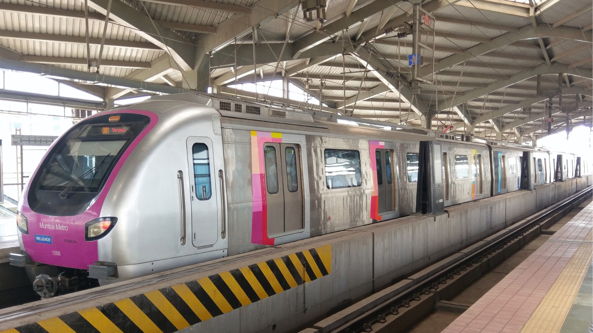
The Mumbai Metro is a critical part of Mumbai’s public transportation system, aimed at addressing the city’s severe traffic congestion and providing a reliable, efficient means of travel. Here’s a detailed look at the Mumbai Metro:
History and Development
- Initiation: The idea for a metro system in Mumbai emerged in the early 2000s to alleviate the city’s traffic issues and offer a modern transportation alternative. Feasibility studies and planning began in the mid-2000s.
- Construction: Construction of the Mumbai Metro began in 2008. The project has been developed in phases, with various lines and extensions planned to cover the city’s extensive and diverse urban landscape.
- Opening: The first section of the Mumbai Metro, part of Line 1, began operations on June 8, 2014.
Network and Lines
The Mumbai Metro network is organized into several lines, with ongoing expansions to enhance coverage:
Line 1 (Versova-Andheri-Ghatkopar Line):
- Route: Versova to Ghatkopar
- Length: Approximately 11.4 km
- Highlights: This line connects western and eastern suburbs of Mumbai, passing through key areas like Andheri, D N Nagar, and Ghatkopar. It is a crucial east-west corridor in Mumbai.
Line 2A (Dahisar-Eastern Express Highway Line):
- Route: Dahisar to D N Nagar
- Length: Approximately 18.6 km
- Highlights: This line runs parallel to Line 1 but covers a more northern section of Mumbai, connecting Dahisar to D N Nagar and providing critical connectivity in the western suburbs.
Line 2B (D N Nagar-Mandalay Line):
- Route: D N Nagar to Mandalay
- Length: Approximately 23.5 km
- Highlights: This line extends from D N Nagar to Mandalay, linking important areas and integrating with the existing network at D N Nagar.
Line 3 (Aqua Line):
- Route: Colaba to Seepz
- Length: Approximately 33.5 km
- Highlights: The Aqua Line is one of the most ambitious projects, connecting the southern part of Mumbai (Colaba) with the western suburbs (Seepz), passing through key commercial and residential areas.
Line 4 (Yellow Line):
- Route: Wadala to Kasarvadavali
- Length: Approximately 32 km
- Highlights: This line connects Wadala in central Mumbai to Kasarvadavali in Thane, integrating with Line 3 and providing crucial connectivity between central and suburban areas.
Line 5 (Red Line):
- Route: Thane to Bhiwandi
- Length: Approximately 40 km (under construction)
- Highlights: This line will extend from Thane to Bhiwandi, enhancing connectivity in the eastern suburbs and integrating with other lines in the network.
Line 6 (Orange Line):
- Route: Lokhandwala to Lower Parel
- Length: Approximately 15.5 km (under construction)
- Highlights: This line will connect Lokhandwala to Lower Parel, providing vital links between key business and residential areas.
Line 7 (Pink Line):
- Route: Dahisar East to Gundavali
- Length: Approximately 16.5 km (under construction)
- Highlights: This line will run from Dahisar East to Gundavali, improving connectivity in the northern and central parts of the city.
Features and Technology
- Stations: Mumbai Metro stations are designed with modern facilities, including escalators, elevators, automated ticket vending machines, and digital information boards. Stations are built to be accessible and user-friendly.
- Trains: The trains are air-conditioned, equipped with safety features, and designed for comfort. They feature real-time information displays and secure boarding areas.
- Ticketing: The metro uses a smart card system called the “Mumbai Metro Card,” which offers convenience and discounts. Single journey tickets and various passes are also available at stations.
Expansion and Future Plans
- Ongoing Projects: Mumbai Metro is continuously expanding with new lines and extensions:
- Line 3: Expected to enhance connectivity between Colaba and Seepz, connecting key commercial districts and residential areas.
- Line 4: Providing crucial links between central Mumbai and suburban areas.
- Line 5: Extending the network to Thane and Bhiwandi.
- Line 6 and 7: Further extending connectivity across different parts of the city.
Economic and Social Impact
- Traffic Decongestion: The Mumbai Metro provides a reliable alternative to road transport, helping to alleviate traffic congestion in the city.
- Economic Growth: Improved connectivity has spurred economic activity, particularly in commercial and business districts, and has facilitated easier access to various parts of Mumbai.
- Quality of Life: The metro system has made commuting more comfortable and efficient, contributing to a better quality of life for Mumbai’s residents.
Safety and Efficiency
- Safety Measures: The Mumbai Metro is equipped with advanced safety features, including fire detection systems, surveillance cameras, and emergency communication facilities.
- Operational Efficiency: Known for its operational standards and punctuality, the metro system adheres to best practices in urban transit.
Conclusion
The Mumbai Metro is a transformative project for the city, offering a modern, efficient, and eco-friendly alternative to traditional road transport. With its expanding network and ongoing developments, the metro is set to play a crucial role in improving connectivity, reducing traffic congestion, and supporting economic growth in Mumbai. As new lines and extensions are completed, the Mumbai Metro will continue to enhance the urban landscape and transportation experience for its residents.

7. Ahemdabad Metro (GMRC)
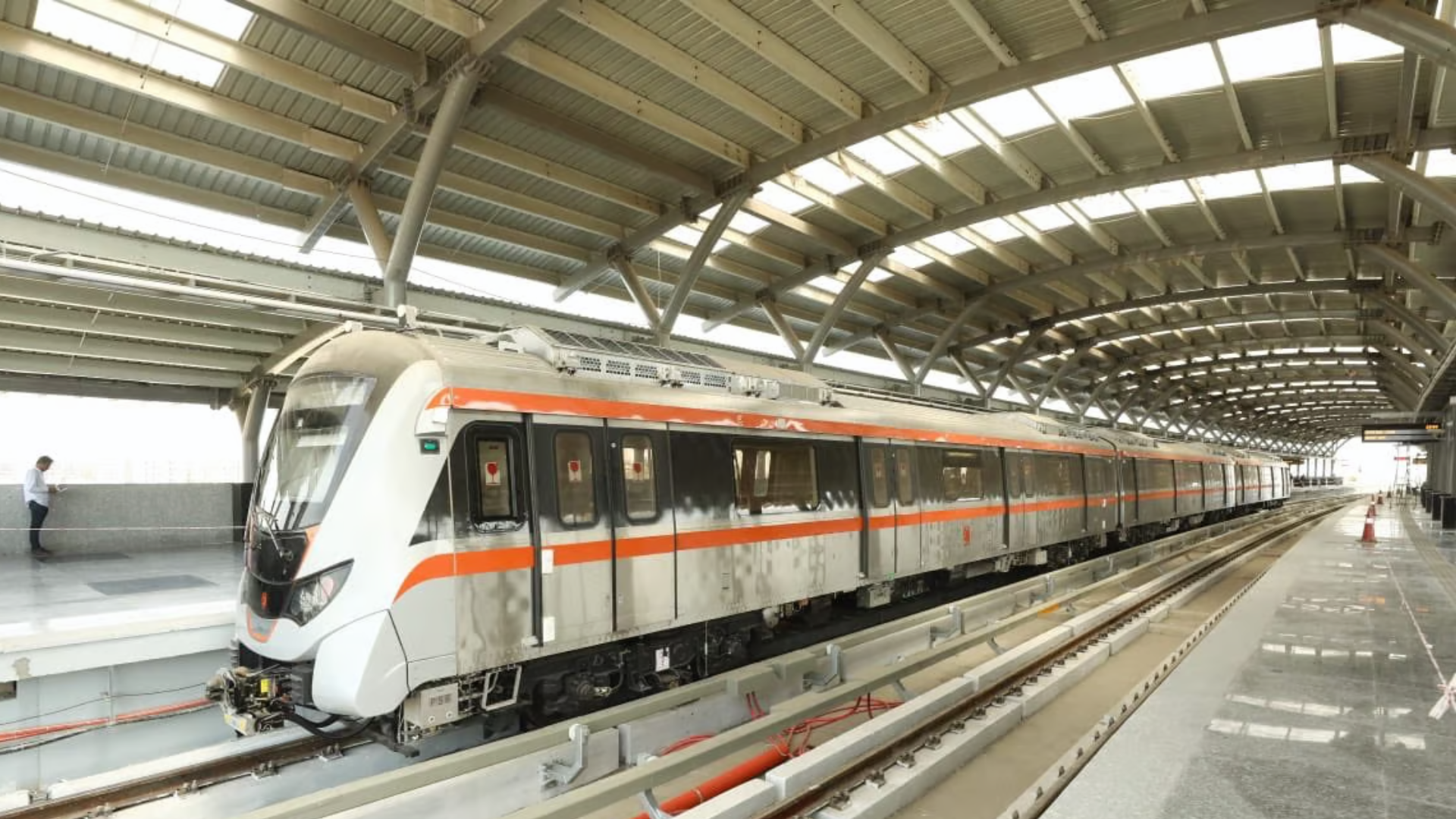
The Ahmedabad Metro, officially known as the Ahmedabad Metro Rail Project, is an urban transit system designed to alleviate traffic congestion and enhance connectivity in Ahmedabad, Gujarat. Here’s a detailed overview of the Ahmedabad Metro:
History and Development
- Initiation: The idea of a metro system for Ahmedabad was proposed to address the city’s growing traffic congestion and to provide a modern transportation solution. The project received approval in 2014.
- Construction: Construction of the Ahmedabad Metro began in 2015, with the project managed by the Gujarat Metro Rail Corporation (GMRC), a joint venture between the Government of India and the Government of Gujarat.
- Opening: The first section of the Ahmedabad Metro, part of the Phase 1 project, began operations on January 4, 2019.
Network and Lines
The Ahmedabad Metro is divided into two main lines under Phase 1, with plans for further expansion:
Line 1 (North-South Corridor):
- Route: Ameerpet to Vastral Gam
- Length: Approximately 40.0 km
- Highlights: This line connects the northern and southern parts of Ahmedabad, passing through important areas such as the City Centre, Kalupur, and Vastral Gam. It serves key commercial and residential areas.
Line 2 (East-West Corridor):
- Route: Wadala to Muktidham
- Length: Approximately 21.0 km
- Highlights: This line runs east to west and connects areas such as Vastral, Kalupur, and Wadala. It integrates with Line 1 at Kalupur and provides connectivity to important residential and business districts.
Expansion and Future Plans
- Phase 2: The expansion plans for Phase 2 are underway, which will further extend the network and improve connectivity across the city:
- Line 3 (Green Line): Proposed to extend from the western suburbs to the eastern parts of the city.
- Line 4 (Pink Line): Expected to connect additional residential and business areas.
- Future Expansion: Additional lines and extensions are planned to enhance coverage and integrate with other transport systems, such as bus networks and suburban railways.
Features and Technology
- Stations: Ahmedabad Metro stations are equipped with modern facilities including escalators, elevators, automated ticket vending machines, and digital information boards. Stations are designed to be accessible to all passengers.
- Trains: The trains are air-conditioned and designed for comfort, featuring real-time information displays and safety mechanisms. They are equipped with advanced safety features, including CCTV and emergency communication systems.
- Ticketing: The metro uses a smart card system known as the “Metro Card,” which facilitates easy and efficient travel. Single-journey tickets and various passes are also available at stations.
Economic and Social Impact
- Traffic Decongestion: The Ahmedabad Metro has significantly alleviated traffic congestion by providing a reliable and efficient alternative to road transport.
- Economic Growth: Improved connectivity has spurred economic activities, particularly in commercial and business districts, and has facilitated easier access to various parts of Ahmedabad.
- Quality of Life: The metro system has made commuting more comfortable and efficient, contributing to a better quality of life for the city’s residents.
Safety and Efficiency
- Safety Measures: The Ahmedabad Metro is equipped with advanced safety systems, including fire detection and alarm systems, surveillance cameras, and emergency communication facilities.
- Operational Efficiency: The metro operates with high punctuality and efficiency, adhering to international standards for urban transit systems.
Conclusion
The Ahmedabad Metro is a significant development in the city’s public transportation infrastructure, offering a modern, efficient, and eco-friendly alternative to traditional road transport. With its expanding network and ongoing projects, the Ahmedabad Metro is set to further enhance connectivity, reduce traffic congestion, and support economic growth in Ahmedabad. As new lines and extensions are completed, the metro will continue to play a crucial role in shaping the urban landscape and improving the transportation experience for the city’s residents.
8. Nagpur Metro (MahaMetro)
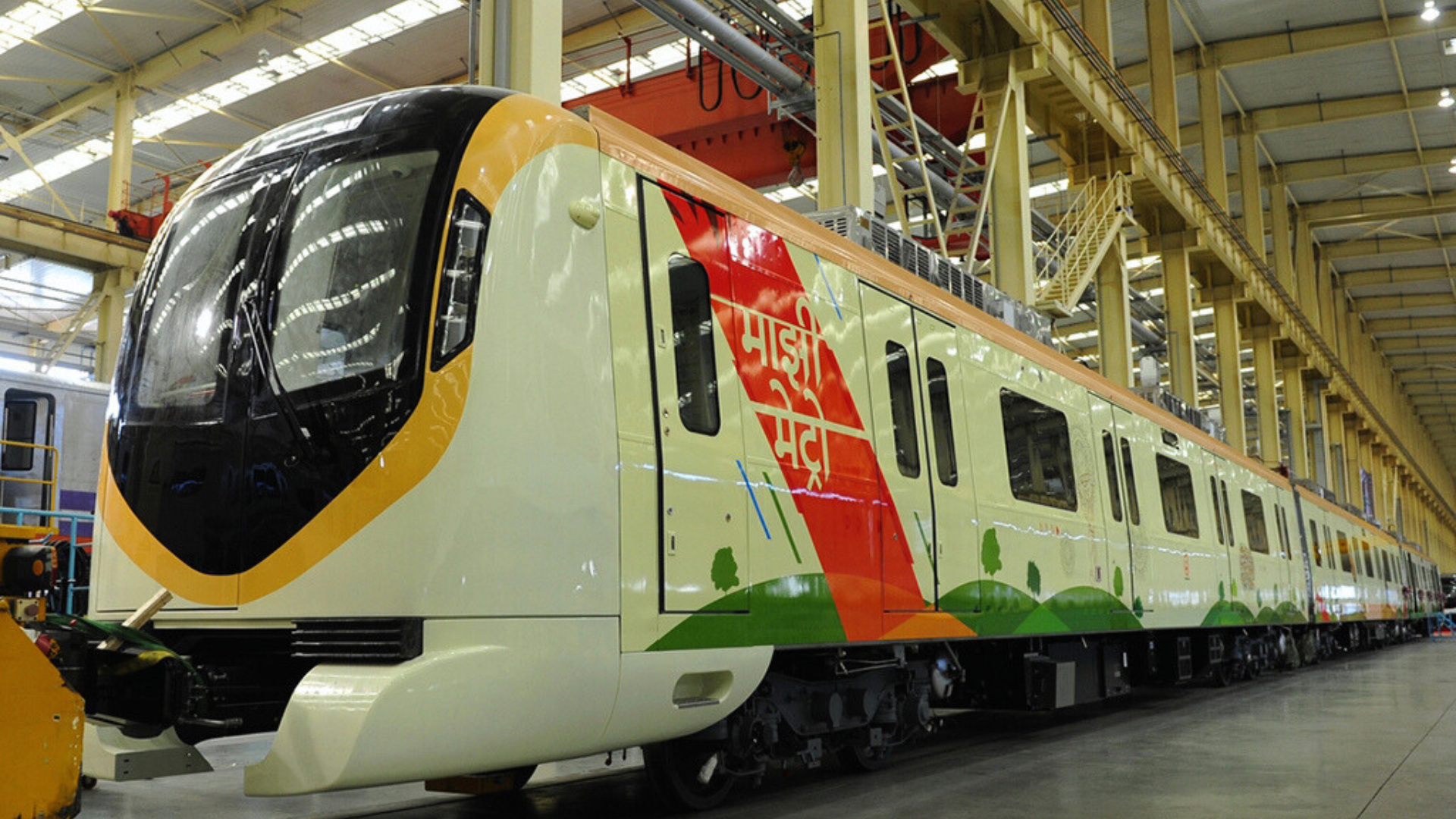
The Nagpur Metro is a significant urban transit project designed to enhance connectivity and address traffic congestion in Nagpur, Maharashtra. Here’s a comprehensive overview of the Nagpur Metro:
History and Development
- Initiation: The Nagpur Metro project was conceived as part of the Central Government’s push to develop metro rail systems in various Indian cities to improve urban transportation. The project was formally approved in 2014.
- Construction: Construction began in 2015, managed by the Nagpur Metro Rail Corporation Limited (NMRCL), a joint venture between the Government of India and the Government of Maharashtra.
- Opening: The first phase of the Nagpur Metro was inaugurated on March 8, 2019. The initial operational stretch was between Sitabuldi and Khapri.
Network and Lines
The Nagpur Metro network is divided into two primary corridors:
Aqua Line (Line 1):
- Route: Khapri to Sitabuldi
- Length: Approximately 13.5 km
- Highlights: This line runs from Khapri in the northwest to Sitabuldi in the city center, passing through important areas such as Ajni and Dharampeth. It is designed to serve the central and northern parts of Nagpur.
Orange Line (Line 2):
- Route: Prajapati Nagar to Lokmanya Nagar
- Length: Approximately 19.4 km
- Highlights: This line connects the eastern and southern parts of Nagpur, linking areas such as Prajapati Nagar, Sitabuldi, and Lokmanya Nagar. It intersects with Line 1 at Sitabuldi, facilitating easy transfers between the two lines.
Features and Technology
- Stations: Nagpur Metro stations are equipped with modern amenities including escalators, elevators, automated ticket vending machines, and digital information displays. Stations are designed for accessibility and passenger comfort.
- Trains: The trains are air-conditioned and feature modern amenities, including real-time information displays and safety systems. They are designed to ensure comfort and safety for passengers.
- Ticketing: The metro uses a smart card system called the “Metro Card,” which allows for convenient and efficient travel. Single journey tickets and various passes are also available at the stations.
Expansion and Future Plans
- Phase 2: The Nagpur Metro’s expansion plans include extending the current lines and introducing new corridors to enhance connectivity across the city. This includes:
- Extension of Line 1: To further extend the reach of the Aqua Line.
- Additional Lines: New lines and extensions are planned to connect more residential, commercial, and business areas across Nagpur.
Economic and Social Impact
- Traffic Decongestion: The Nagpur Metro aims to alleviate traffic congestion by providing a reliable and efficient alternative to road transport.
- Economic Development: Improved connectivity is expected to boost economic activities, particularly in commercial and business districts, and facilitate easier access to various parts of the city.
- Quality of Life: The metro system contributes to a better quality of life by making commuting more comfortable and reducing travel times.
Safety and Efficiency
- Safety Measures: The Nagpur Metro is equipped with advanced safety systems, including fire detection, surveillance cameras, and emergency communication facilities.
- Operational Efficiency: The metro operates with a focus on punctuality and efficiency, adhering to best practices in urban transit systems.
Conclusion
The Nagpur Metro represents a significant advancement in Nagpur’s urban transportation infrastructure. It provides a modern, efficient, and eco-friendly alternative to traditional road transport, helping to reduce traffic congestion and improve connectivity across the city. With its expanding network and ongoing development, the Nagpur Metro is set to play a crucial role in shaping the city’s urban landscape and enhancing the overall commuting experience for its residents.

9. Pune Metro (MahaMetro)
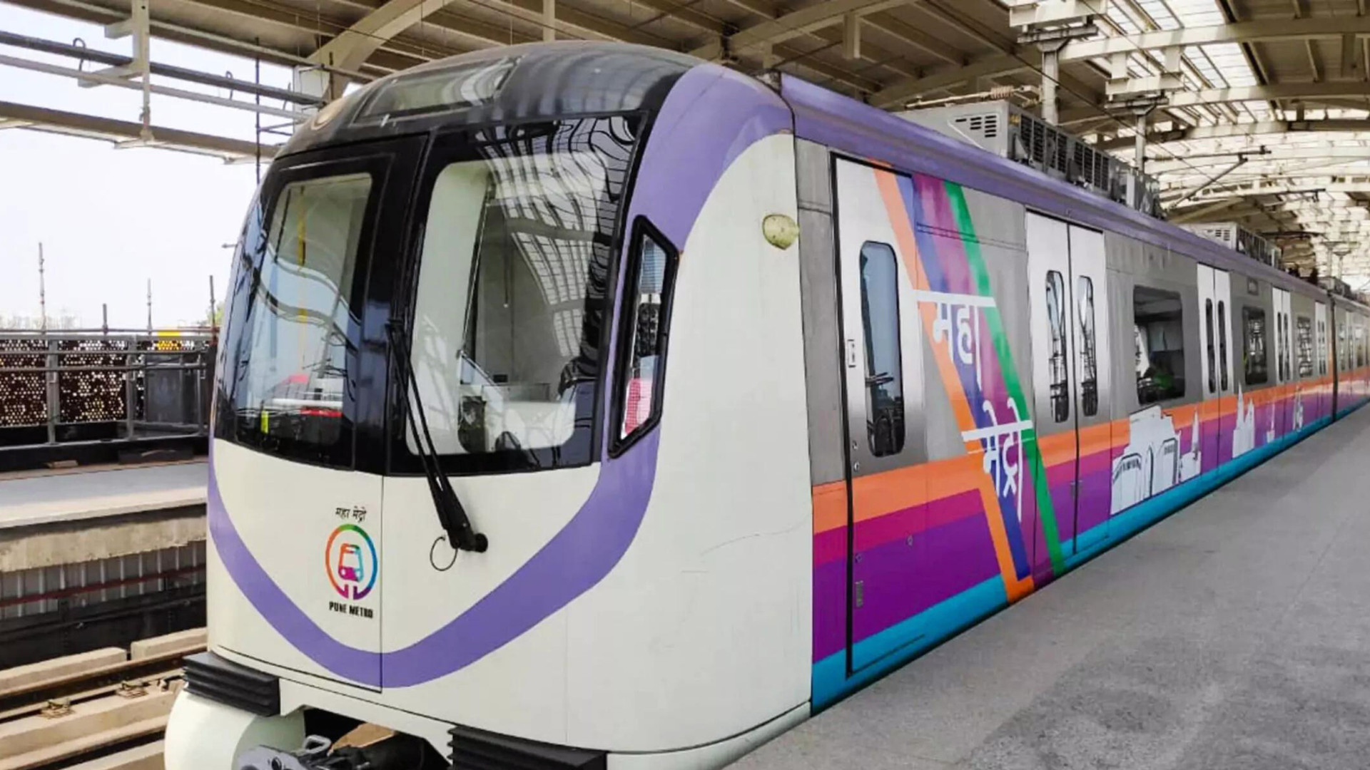
The Pune Metro is an important urban transit project aimed at improving connectivity and addressing the traffic congestion issues in Pune, Maharashtra. Here’s a detailed look at the Pune Metro:
History and Development
- Initiation: The concept of a metro system for Pune was proposed to address the city’s growing traffic congestion and to provide a modern, efficient mode of transportation. The project was officially approved in 2016.
- Construction: Construction of the Pune Metro began in 2017, managed by the Pune Metro Rail Corporation Limited (PMRCL), a joint venture between the Government of India and the Government of Maharashtra.
- Opening: The first stretch of the Pune Metro, part of Phase 1, began operations on March 6, 2022.
Network and Lines
The Pune Metro network is divided into two main lines under Phase 1, with plans for further expansion:
Line 1 (Purple Line):
- Route: PCMC (Pimpri-Chinchwad) to Swargate
- Length: Approximately 16.5 km
- Highlights: This line connects the Pimpri-Chinchwad area in the north to Swargate in the south, passing through important areas such as Pune Municipal Corporation (PMC), Balewadi, and Shivajinagar.
Line 2 (Aqua Line):
- Route: Vanaz to Gundavali
- Length: Approximately 7.4 km
- Highlights: This line connects Vanaz in the western suburbs to Gundavali, providing vital links to the commercial and residential areas in between.
Expansion and Future Plans
- Phase 2: The expansion of the Pune Metro is planned to include new lines and extensions to further improve connectivity across the city:
- Line 3: This line is proposed to connect the central parts of Pune to the eastern suburbs, extending the network’s reach.
- Line 4: Plans are in place for extending the network to other key areas, including links to the Pune International Airport and other major locations.
Features and Technology
- Stations: Pune Metro stations are designed with modern facilities, including escalators, elevators, automated ticket vending machines, and digital information boards. Stations aim to be accessible and comfortable for all passengers.
- Trains: The metro trains are air-conditioned and equipped with modern amenities, including real-time information displays and safety systems. They are designed for passenger comfort and safety.
- Ticketing: The metro uses a smart card system, known as the “Metro Card,” which facilitates easy and efficient travel. Single-journey tickets and various passes are also available at stations.
Economic and Social Impact
- Traffic Decongestion: The Pune Metro aims to alleviate traffic congestion by providing a reliable and efficient alternative to road transport.
- Economic Growth: Improved connectivity is expected to boost economic activities, particularly in commercial and business districts, and facilitate easier access to different parts of the city.
- Quality of Life: The metro system enhances the quality of life by reducing travel times, making commuting more comfortable, and providing a modern transportation solution.
Safety and Efficiency
- Safety Measures: The Pune Metro is equipped with advanced safety features, including fire detection systems, surveillance cameras, and emergency communication facilities.
- Operational Efficiency: The metro system operates with high standards of punctuality and efficiency, adhering to best practices in urban transit systems.
Conclusion
The Pune Metro represents a significant advancement in Pune’s public transportation infrastructure. It offers a modern, efficient, and eco-friendly alternative to traditional road transport, helping to reduce traffic congestion and improve connectivity across the city. With ongoing expansions and future developments, the Pune Metro is set to play a crucial role in enhancing urban mobility, supporting economic growth, and improving the overall commuting experience for the residents of Pune.
10. Kochi Metro (KMRL)
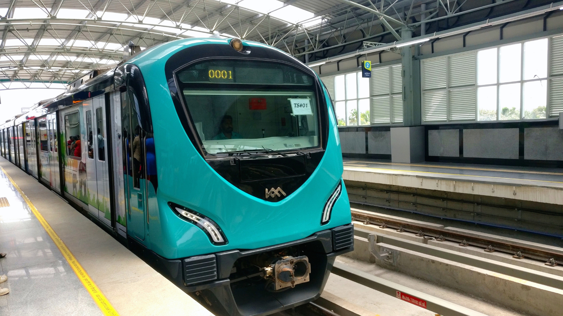
The Kochi Metro is a notable urban transit system in the city of Kochi, Kerala, designed to address traffic congestion and provide an efficient transportation option. Here’s a comprehensive look at the Kochi Metro:
History and Development
- Initiation: The idea for a metro system in Kochi emerged to manage the city’s rapid urbanization and traffic issues. The project was officially approved in 2012.
- Construction: Construction of the Kochi Metro began in 2013 under the management of the Kochi Metro Rail Limited (KMRL), a joint venture between the Government of India and the Government of Kerala.
- Opening: The first stretch of the Kochi Metro was inaugurated on June 19, 2017, with services starting between Aluva and Palarivattom.
Network and Lines
The Kochi Metro network is structured into a single line, with future expansions planned:
- Line 1:
- Route: Aluva to Petta
- Length: Approximately 25.6 km
- Highlights: This line connects the northern suburbs of Aluva to the southern end at Petta, passing through key areas such as Palarivattom, MG Road, and Vytilla. It integrates with other public transport systems like buses and ferries at various points.
Expansion and Future Plans
- Phase 2: The expansion of the Kochi Metro includes the following:
- Line 1 Extension: Extending the existing line from Petta to S.N. Junction.
- Line 2: Planned to connect the JLN Stadium area to the IT hub in Kakkanad, further improving connectivity in the city.
- Line 3 and 4: Future lines are under consideration to cover more areas, including additional suburbs and key locations within Kochi.
Features and Technology
- Stations: Kochi Metro stations are equipped with modern amenities, including escalators, elevators, automated ticket vending machines, and digital information boards. Stations are designed to be accessible for all passengers, including those with disabilities.
- Trains: The trains are air-conditioned and designed for passenger comfort. They feature safety systems such as CCTV surveillance, real-time information displays, and emergency communication systems.
- Ticketing: The metro uses a smart card system known as the “Kochi 1 Card,” which allows for convenient and efficient travel. Single-journey tickets and various passes are also available at the stations.
Economic and Social Impact
- Traffic Decongestion: The Kochi Metro provides a significant relief from traffic congestion by offering a reliable and efficient public transport option.
- Economic Development: Improved connectivity has spurred economic activities, particularly in commercial areas along the metro route, and facilitated easier access to key locations.
- Quality of Life: The metro system enhances the quality of life by reducing travel times, offering a comfortable and efficient commuting option, and integrating with other modes of transport.
Safety and Efficiency
- Safety Measures: The Kochi Metro is equipped with advanced safety features, including fire detection systems, surveillance cameras, and emergency communication facilities.
- Operational Efficiency: Known for its punctuality and operational standards, the metro adheres to best practices in urban transit systems, ensuring reliable service for its passengers.
Environmental Impact
- Eco-Friendly: The Kochi Metro is designed to be an environmentally friendly transport option, aiming to reduce the carbon footprint associated with road transport. It helps in promoting sustainable urban mobility by integrating with green initiatives and reducing traffic congestion.
Conclusion
The Kochi Metro represents a significant advancement in Kochi’s public transportation infrastructure. With its modern design, efficient operations, and ongoing expansion plans, the Kochi Metro is set to play a crucial role in enhancing urban mobility, supporting economic growth, and improving the overall commuting experience for residents. The system’s integration with other forms of transport and its focus on environmental sustainability highlight its importance in shaping the future of transportation in Kochi.

11. Lucknow Metro (UPMRC)
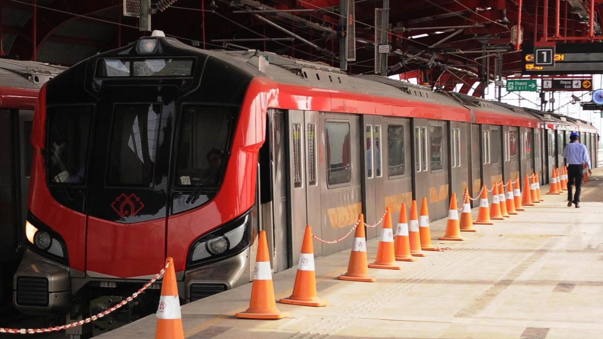
The Lucknow Metro is a crucial urban transit system designed to improve connectivity and address traffic congestion in Lucknow, Uttar Pradesh. Here’s a detailed overview of the Lucknow Metro:
History and Development
- Initiation: The concept of a metro system in Lucknow was proposed to manage the city’s growing transportation needs and traffic congestion. The project received approval in 2013.
- Construction: Construction of the Lucknow Metro began in 2014, managed by the Lucknow Metro Rail Corporation Limited (LMRC), a joint venture between the Government of India and the Government of Uttar Pradesh.
- Opening: The first section of the Lucknow Metro, part of the North-South Corridor (Line 1), began operations on September 5, 2017.
Network and Lines
The Lucknow Metro network consists of two main lines under Phase 1, with plans for future expansions:
Line 1 (North-South Corridor):
- Route: Munshipulia to Charbagh
- Length: Approximately 22.9 km
- Highlights: This line connects the northern suburbs of Munshipulia with the southern end at Charbagh. It passes through key areas such as Alambagh, Hussainganj, and the City Centre, integrating with other transport options and improving access across central Lucknow.
Line 2 (East-West Corridor):
- Route: CCS Airport to Vasant Kunj
- Length: Approximately 23.8 km
- Highlights: This line connects the airport area in the east to Vasant Kunj in the west, linking important residential and commercial districts. It intersects with Line 1 at the Charbagh station, providing a critical connection between the eastern and western parts of the city.
Expansion and Future Plans
- Phase 2: The Lucknow Metro’s expansion plans include extending existing lines and introducing new corridors:
- Line 3 (Circular Line): Proposed to connect various parts of the city and provide additional connectivity.
- Extensions of Line 1 and Line 2: Plans to extend the reach of these lines to cover more areas and integrate with other transport systems.
Features and Technology
- Stations: Lucknow Metro stations are designed with modern facilities including escalators, elevators, automated ticket vending machines, and digital information displays. Stations are built to be accessible and user-friendly.
- Trains: The trains are air-conditioned and designed for passenger comfort, featuring real-time information displays, safety systems, and secure boarding areas.
- Ticketing: The metro uses a smart card system known as the “Lucknow Metro Card,” which facilitates convenient and efficient travel. Single-journey tickets and various passes are also available at stations.
Economic and Social Impact
- Traffic Decongestion: The Lucknow Metro helps alleviate traffic congestion by providing a reliable and efficient alternative to road transport.
- Economic Growth: Improved connectivity has stimulated economic activities, particularly in commercial and business areas along the metro route, and has made it easier to access various parts of the city.
- Quality of Life: The metro system enhances the quality of life by reducing travel times and offering a modern, comfortable commuting option.
Safety and Efficiency
- Safety Measures: The Lucknow Metro is equipped with advanced safety systems including fire detection and alarm systems, CCTV surveillance, and emergency communication facilities.
- Operational Efficiency: The metro adheres to high standards of punctuality and operational efficiency, ensuring a reliable service for passengers.
Environmental Impact
- Eco-Friendly: The Lucknow Metro is designed to be an environmentally friendly transportation option, aiming to reduce the carbon footprint associated with road transport. It supports sustainable urban mobility by reducing traffic congestion and promoting the use of public transport.
Conclusion
The Lucknow Metro is a significant advancement in Lucknow’s public transportation infrastructure, offering a modern, efficient, and eco-friendly alternative to traditional road transport. With its current network and ongoing expansion plans, the metro system is set to play a vital role in improving urban mobility, supporting economic growth, and enhancing the overall commuting experience for residents of Lucknow. The Lucknow Metro’s focus on integrating with other forms of transport and its commitment to environmental sustainability highlight its importance in shaping the city’s future transportation landscape.
12. Jaipur Metro (JMRC)
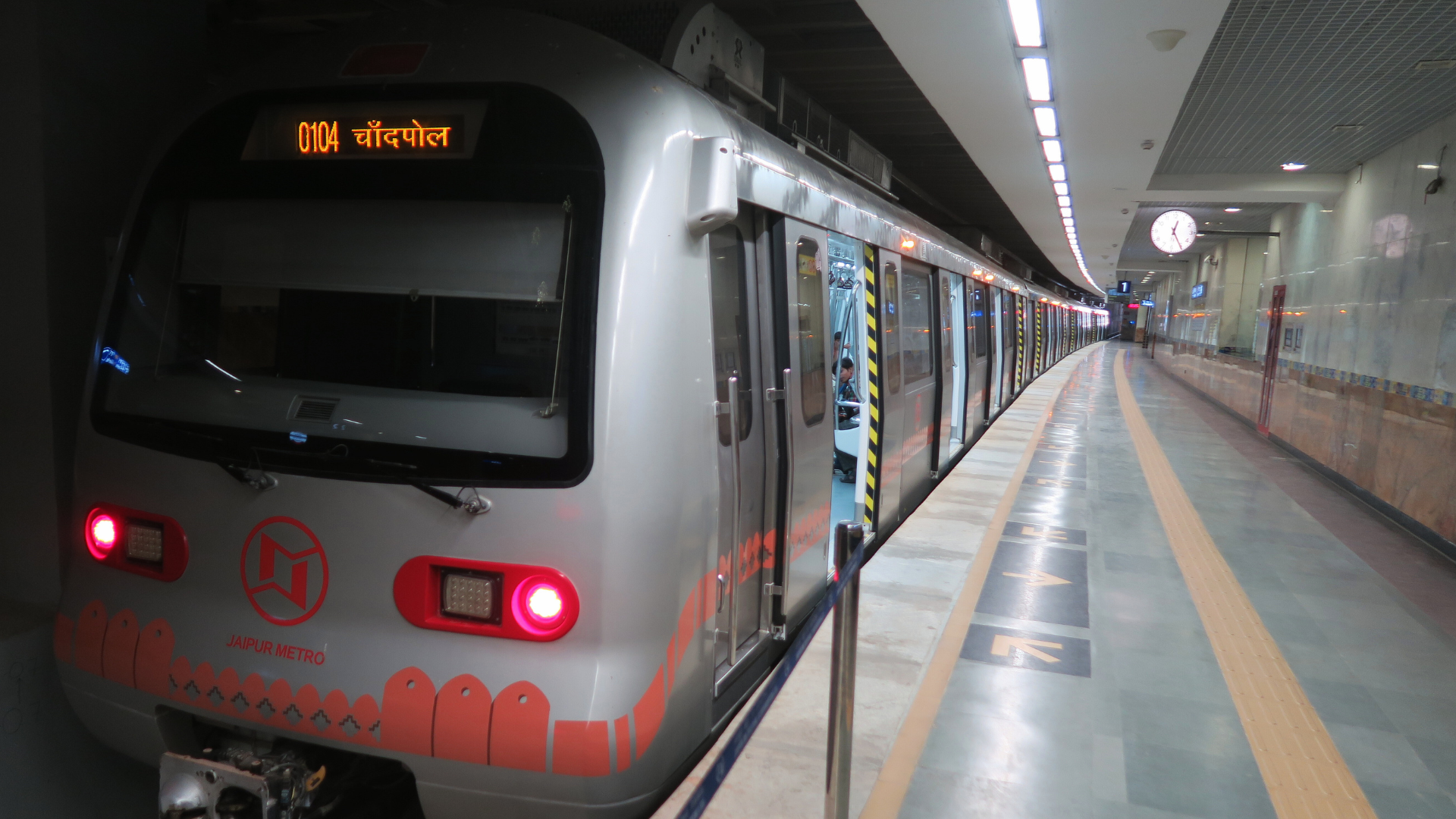
The Jaipur Metro is an essential urban transit project aimed at enhancing transportation infrastructure in Jaipur, Rajasthan. It addresses traffic congestion and provides a modern, efficient public transportation alternative. Here’s an in-depth look at the Jaipur Metro:
History and Development
- Initiation: The idea of introducing a metro system in Jaipur emerged to tackle the city’s growing traffic congestion and urban mobility challenges. The project was officially approved in 2010.
- Construction: The Jaipur Metro project is managed by the Jaipur Metro Rail Corporation (JMRC), a joint venture between the Government of India and the Government of Rajasthan. Construction began in 2010, with work initially focusing on the first phase of the project.
- Opening: The first stretch of the Jaipur Metro, part of Phase 1, was inaugurated on June 3, 2015.
Network and Lines
The Jaipur Metro network is structured into two main corridors:
Line 1 (Pink Line):
- Route: Mansarovar to Chandpole
- Length: Approximately 9.0 km
- Highlights: This line runs from Mansarovar in the southwest to Chandpole in the northeast, passing through key areas such as Jaipur Railway Station, Sindhi Camp, and the City Palace. It connects important residential and commercial areas in Jaipur.
Line 2 (Orange Line):
- Route: Sitapura Industrial Area to Ambabari
- Length: Approximately 12.1 km (under construction)
- Highlights: This line aims to connect the Sitapura Industrial Area in the south to Ambabari in the north, facilitating better access to industrial and educational zones, as well as residential areas. It is intended to integrate with Line 1 at key points, providing comprehensive coverage of the city.
Expansion and Future Plans
- Phase 2: The Jaipur Metro’s expansion plans are designed to enhance connectivity further:
- Line 2 Extension: The extension will improve links between Sitapura and Ambabari, integrating more neighborhoods and key areas.
- Future Lines: Plans for additional lines and extensions are under consideration to cover more parts of the city, including connections to major suburban areas and business districts.
Features and Technology
- Stations: Jaipur Metro stations are equipped with modern facilities including escalators, elevators, automated ticket vending machines, and digital information displays. Stations are designed for accessibility and passenger convenience.
- Trains: The metro trains are air-conditioned and designed for comfort, featuring real-time information displays and safety systems. They offer a modern commuting experience with a focus on passenger comfort.
- Ticketing: The Jaipur Metro uses a smart card system known as the “Jaipur Metro Card,” which allows for convenient and efficient travel. Single-journey tickets and various passes are also available at the stations.
Economic and Social Impact
- Traffic Decongestion: The Jaipur Metro helps alleviate traffic congestion by providing a reliable and efficient alternative to road transport, thus reducing travel time and improving urban mobility.
- Economic Development: Improved connectivity boosts economic activities, particularly in commercial and business areas along the metro route, and enhances access to various parts of Jaipur.
- Quality of Life: The metro system improves the quality of life by offering a comfortable and efficient commuting option, reducing travel time, and providing a modern transportation solution.
Safety and Efficiency
- Safety Measures: The Jaipur Metro is equipped with advanced safety features, including fire detection and alarm systems, CCTV surveillance, and emergency communication facilities.
- Operational Efficiency: Known for its punctuality and operational standards, the metro system adheres to best practices in urban transit, ensuring reliable service for passengers.
Environmental Impact
- Eco-Friendly: The Jaipur Metro is designed to be an environmentally friendly transportation option. It aims to reduce the carbon footprint associated with road transport and supports sustainable urban mobility by integrating with other forms of public transport.
Conclusion
The Jaipur Metro is a significant advancement in the city’s public transportation infrastructure. It offers a modern, efficient, and eco-friendly alternative to traditional road transport, helping to reduce traffic congestion and improve connectivity across Jaipur. With its existing network and future expansion plans, the Jaipur Metro is set to play a crucial role in enhancing urban mobility, supporting economic growth, and improving the overall commuting experience for residents. The system’s focus on integrating with other transport modes and its commitment to sustainability highlight its importance in shaping the future of Jaipur’s transportation landscape.

13. Kanpur Metro (UPMRC)
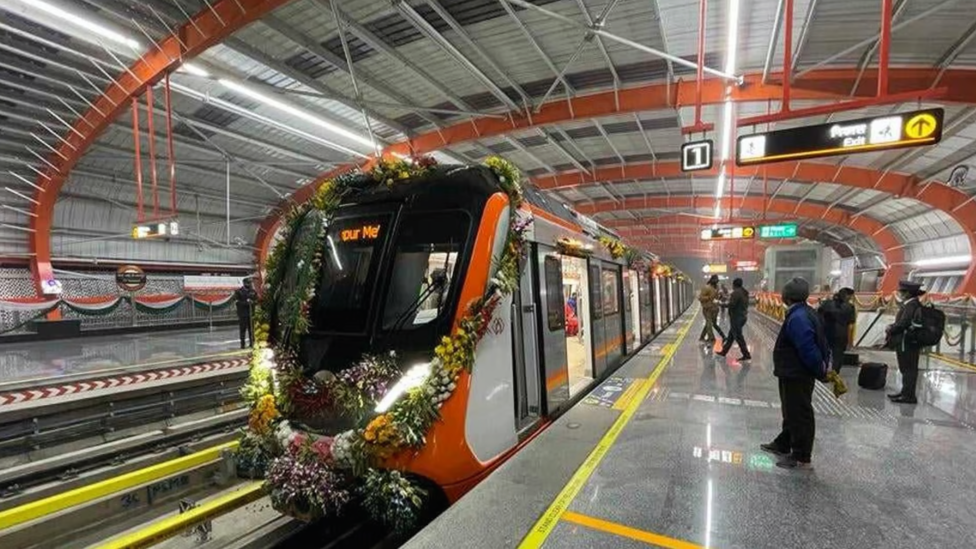
The Kanpur Metro is an ambitious urban transit project aimed at improving public transportation and addressing traffic congestion in Kanpur, Uttar Pradesh. Here’s a comprehensive overview of the Kanpur Metro:
History and Development
- Initiation: The Kanpur Metro project was proposed to provide a modern, efficient public transport system to tackle the city’s increasing traffic congestion and mobility issues. The project received formal approval in 2014.
- Construction: Construction of the Kanpur Metro is overseen by the Kanpur Metro Rail Corporation Limited (KMRCL), a joint venture between the Government of India and the Government of Uttar Pradesh. Construction work began in 2016.
- Opening: The first phase of the Kanpur Metro was inaugurated on December 28, 2021, with services starting on the initial stretch between IIT Kanpur and Moti Jheel.
Network and Lines
The Kanpur Metro network is planned to be developed in phases, with the current focus on Phase 1:
- Line 1 (North-South Corridor):
- Route: IIT Kanpur to Moti Jheel
- Length: Approximately 23.8 km
- Highlights: This line connects the northern part of the city at IIT Kanpur to the southern end at Moti Jheel, passing through major areas such as Kanpur Central Railway Station, Jhakarkati, and Charbagh. It integrates with existing transport systems and serves key residential, commercial, and educational areas.
Expansion and Future Plans
- Phase 2: Future plans for the Kanpur Metro include extending the current line and introducing new corridors to enhance connectivity:
- Extension of Line 1: Planned to extend the reach of the North-South Corridor to cover additional areas and improve connectivity.
- New Lines: Proposals for new lines and extensions are under consideration to connect more parts of Kanpur and integrate with other transport systems, including suburban areas and business hubs.
Features and Technology
- Stations: Kanpur Metro stations are designed with modern amenities, including escalators, elevators, automated ticket vending machines, and digital information boards. Stations are built to ensure accessibility and passenger comfort.
- Trains: The metro trains are air-conditioned and feature real-time information displays, safety systems, and comfortable seating. They are designed to provide a smooth and reliable commuting experience.
- Ticketing: The metro uses a smart card system known as the “Kanpur Metro Card,” which facilitates easy and efficient travel. Single-journey tickets and various passes are also available at the stations.
Economic and Social Impact
- Traffic Decongestion: The Kanpur Metro aims to alleviate traffic congestion by offering a reliable and efficient alternative to road transport, thereby reducing travel times and improving urban mobility.
- Economic Growth: Improved connectivity is expected to boost economic activities in commercial areas along the metro route and facilitate easier access to various parts of Kanpur.
- Quality of Life: The metro system contributes to a better quality of life by reducing travel times, providing a modern transportation solution, and enhancing overall commuting comfort.
Safety and Efficiency
- Safety Measures: The Kanpur Metro is equipped with advanced safety features, including fire detection systems, surveillance cameras, and emergency communication facilities.
- Operational Efficiency: The metro operates with high standards of punctuality and efficiency, adhering to best practices in urban transit systems to ensure reliable service for passengers.
Environmental Impact
- Eco-Friendly: The Kanpur Metro is designed to be an environmentally friendly transportation option, aimed at reducing the carbon footprint associated with road transport. It supports sustainable urban mobility by decreasing traffic congestion and promoting public transport usage.
Conclusion
The Kanpur Metro is a significant development in the city’s public transportation infrastructure, offering a modern, efficient, and eco-friendly alternative to traditional road transport. With its current network and future expansion plans, the metro is set to play a crucial role in enhancing urban mobility, supporting economic growth, and improving the overall commuting experience for Kanpur residents. The system’s integration with other transport modes and its commitment to environmental sustainability highlight its importance in shaping the future of Kanpur’s transportation landscape.
14. Agra Metro (UPMRC)
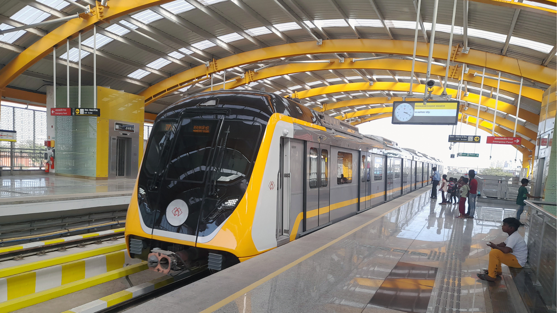
The Agra Metro is an ambitious urban transit project designed to address traffic congestion and enhance public transportation in Agra, Uttar Pradesh. Here’s an in-depth look at the Agra Metro:
History and Development
- Initiation: The Agra Metro project was conceived to provide a modern public transport solution to tackle the city’s increasing traffic congestion and mobility challenges. The project was approved in 2019.
- Construction: The construction of the Agra Metro is managed by the Agra Metro Rail Corporation (AMRC), a joint venture between the Government of India and the Government of Uttar Pradesh. Work on the metro began in 2020.
- Opening: As of now, the metro is in the construction phase, with expected completion and operational phases planned for the coming years.
Network and Lines
The Agra Metro is planned to consist of two main lines, with an initial focus on Phase 1:
Line 1 (North-South Corridor):
- Route: Sikandra to Agra Cantt
- Length: Approximately 14.2 km
- Highlights: This line will connect Sikandra in the north to Agra Cantt in the south, covering important areas including the Taj Mahal and Agra Fort. It is designed to facilitate better connectivity across key landmarks and commercial districts.
Line 2 (East-West Corridor):
- Route: Taj East Gate to Jama Masjid
- Length: Approximately 11.2 km
- Highlights: This line will run from the Taj East Gate area to Jama Masjid, connecting significant parts of the city including cultural and historical sites. It will provide important links between major attractions and residential areas.
Expansion and Future Plans
- Further Expansion: Plans for further expansion of the Agra Metro include additional lines and extensions to cover more areas of the city. These future expansions aim to improve connectivity and integrate with other forms of public transportation.
Features and Technology
- Stations: Agra Metro stations are designed with modern amenities such as escalators, elevators, automated ticket vending machines, and digital information displays. Stations will be built to ensure accessibility and comfort for all passengers.
- Trains: The metro trains will be air-conditioned and equipped with real-time information displays, safety systems, and comfortable seating arrangements. They are designed to provide a smooth and reliable commuting experience.
- Ticketing: The metro system will use a smart card system known as the “Agra Metro Card,” which will facilitate convenient and efficient travel. Single-journey tickets and various passes will also be available.
Economic and Social Impact
- Traffic Decongestion: The Agra Metro aims to alleviate traffic congestion by providing an efficient and reliable alternative to road transport, reducing travel times, and improving overall urban mobility.
- Economic Growth: The metro is expected to boost economic activities in commercial areas along the route and enhance access to various parts of Agra, including major tourist attractions.
- Quality of Life: The metro system will contribute to a better quality of life by offering a modern, comfortable commuting option, reducing travel time, and improving accessibility.
Safety and Efficiency
- Safety Measures: The Agra Metro will be equipped with advanced safety features, including fire detection systems, surveillance cameras, and emergency communication facilities to ensure passenger safety.
- Operational Efficiency: The metro will adhere to high standards of punctuality and efficiency, following best practices in urban transit to provide reliable service for passengers.
Environmental Impact
- Eco-Friendly: The Agra Metro is designed to be an environmentally friendly transportation option, aiming to reduce the carbon footprint associated with road transport. It supports sustainable urban mobility by decreasing traffic congestion and promoting the use of public transport.
Conclusion
The Agra Metro is poised to be a significant enhancement in Agra’s public transportation infrastructure. With its planned network, modern amenities, and future expansion plans, the metro will play a crucial role in improving urban mobility, supporting economic development, and enhancing the overall commuting experience for residents and visitors. Its focus on integrating with other transport modes and commitment to environmental sustainability underscore its importance in shaping the future of transportation in Agra.

15. Bhoj Metro (MPMRCL)
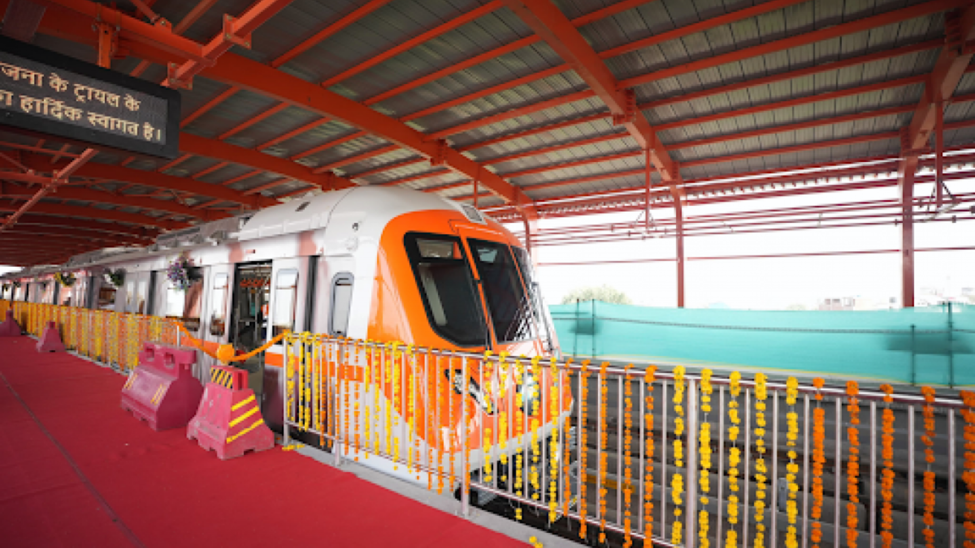
The Bhoj Metro, also referred to as the Bhopal Metro, is a significant public transportation project aimed at improving urban mobility in Bhopal, Madhya Pradesh. Here’s a detailed overview of the Bhopal Metro:
History and Development
- Initiation: The idea of a metro system in Bhopal emerged to address the growing transportation needs and traffic congestion in the city. The project was officially approved in 2010.
- Construction: The Bhopal Metro is managed by the Bhopal Metro Rail Corporation (BMRC), a joint venture between the Government of India and the Government of Madhya Pradesh. Construction began in 2017.
- Opening: The initial sections of the Bhopal Metro were inaugurated on April 15, 2023.
Network and Lines
The Bhopal Metro network is initially planned with a single line under Phase 1:
- Line 1 (East-West Corridor):
- Route: The line runs from the eastern part of the city at the Habibganj Railway Station to the western end at the Bhopal Smart City area.
- Length: Approximately 27.87 km
- Highlights: This line connects major areas such as Habibganj, Bhopal Junction, and the Smart City area. It serves significant commercial, residential, and administrative zones and is designed to integrate with other transportation systems.
Expansion and Future Plans
- Phase 2 and Extensions: Future plans include extending Line 1 and potentially introducing new lines to cover additional parts of Bhopal and integrate with suburban areas. The extensions aim to improve connectivity and enhance the overall reach of the metro system.
Features and Technology
- Stations: The Bhopal Metro stations are designed to be modern and accessible, with amenities including escalators, elevators, automated ticket vending machines, and digital information boards. Stations are built to ensure ease of access and comfort for passengers.
- Trains: The metro trains are air-conditioned and designed for passenger comfort, featuring real-time information displays, safety systems, and comfortable seating.
- Ticketing: The metro uses a smart card system known as the “Bhopal Metro Card,” facilitating convenient and efficient travel. Single-journey tickets and various passes are also available at the stations.
Economic and Social Impact
- Traffic Decongestion: The Bhopal Metro aims to reduce traffic congestion by offering a reliable and efficient alternative to road transport. This will help in reducing travel times and improving urban mobility.
- Economic Development: Enhanced connectivity is expected to boost economic activities, particularly in commercial areas along the metro route, and improve access to various parts of Bhopal.
- Quality of Life: The metro system will improve the quality of life by providing a modern, comfortable commuting option, reducing travel time, and enhancing accessibility across the city.
Safety and Efficiency
- Safety Measures: The Bhopal Metro is equipped with advanced safety features, including fire detection systems, surveillance cameras, and emergency communication facilities.
- Operational Efficiency: The metro system is designed to adhere to high standards of punctuality and operational efficiency, ensuring reliable service for passengers.
Environmental Impact
- Eco-Friendly: The Bhopal Metro is intended to be an environmentally friendly transportation option, aiming to reduce the carbon footprint associated with road transport. It supports sustainable urban mobility by decreasing traffic congestion and promoting public transport usage.
Conclusion
The Bhopal Metro represents a significant development in the city’s public transportation infrastructure. With its modern design, efficient operations, and plans for future expansion, it is set to play a vital role in enhancing urban mobility, supporting economic growth, and improving the overall commuting experience for Bhopal residents. The metro’s focus on integration with other transport modes and commitment to environmental sustainability highlight its importance in shaping the future of transportation in Bhopal.
16. Indore Metro (MPMRCL)
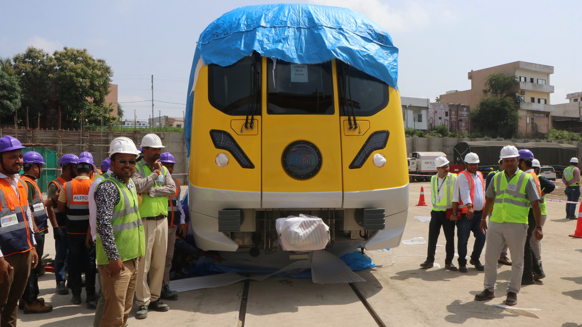
The Indore Metro is an ambitious urban transit project aimed at improving transportation and addressing traffic congestion in Indore, Madhya Pradesh. Here’s a detailed overview of the Indore Metro:
History and Development
- Initiation: The Indore Metro project was proposed to address the city’s growing transportation needs and traffic issues. The idea was to provide a modern public transport system to facilitate better connectivity and reduce congestion. The project received official approval in 2016.
- Construction: Managed by the Indore Metro Rail Corporation (IMRC), a joint venture between the Government of India and the Government of Madhya Pradesh, construction began in 2018. The project is being developed in phases.
- Opening: The first phase of the Indore Metro is expected to be operational by 2025, with initial construction and testing already underway.
Network and Lines
The Indore Metro network is planned with a focus on improving connectivity across the city. The network includes:
- Line 1:
- Route: The primary line runs from the west of the city to the east, connecting key areas such as the Indore Railway Station and other major residential, commercial, and administrative hubs.
- Length: Approximately 31.5 km
- Highlights: Line 1 is designed to connect significant areas, including business districts, educational institutions, and residential neighborhoods. It will integrate with other modes of transport and improve accessibility across Indore.
Expansion and Future Plans
- Phase 2 and Extensions: Future plans for the Indore Metro include extending Line 1 and potentially introducing new lines to cover more areas of the city and surrounding suburbs. These expansions are aimed at further enhancing connectivity and integration with other transport systems.
Features and Technology
- Stations: Indore Metro stations are planned to be modern and equipped with facilities such as escalators, elevators, automated ticket vending machines, and digital information boards. Accessibility and passenger comfort are key design considerations.
- Trains: The metro trains will be air-conditioned, featuring real-time information displays, safety systems, and comfortable seating arrangements to provide a smooth and efficient commuting experience.
- Ticketing: The metro system will use a smart card system, known as the “Indore Metro Card,” to facilitate convenient and efficient travel. Single-journey tickets and various passes will also be available.
Economic and Social Impact
- Traffic Decongestion: The Indore Metro aims to reduce traffic congestion by providing a reliable and efficient alternative to road transport. This will help in reducing travel times and improving overall urban mobility.
- Economic Growth: Improved connectivity is expected to boost economic activities, particularly in commercial areas along the metro route, and enhance access to various parts of Indore.
- Quality of Life: The metro system will contribute to a better quality of life by offering a modern, comfortable commuting option, reducing travel time, and improving accessibility across the city.
Safety and Efficiency
- Safety Measures: The Indore Metro will be equipped with advanced safety features, including fire detection systems, CCTV surveillance, and emergency communication facilities to ensure passenger safety.
- Operational Efficiency: The metro system will adhere to high standards of punctuality and operational efficiency, following best practices in urban transit to provide reliable service for passengers.
Environmental Impact
- Eco-Friendly: The Indore Metro is designed to be an environmentally friendly transportation option, aiming to reduce the carbon footprint associated with road transport. It supports sustainable urban mobility by decreasing traffic congestion and promoting public transport usage.
Conclusion
The Indore Metro is set to be a major enhancement to the city’s public transportation infrastructure. With its modern design, planned expansion, and focus on efficiency, the metro will play a crucial role in improving urban mobility, supporting economic development, and enhancing the overall commuting experience for Indore residents. Its integration with other forms of transport and commitment to environmental sustainability underscore its significance in shaping the future of transportation in Indore

17. Meerut Metro (NCRTC)
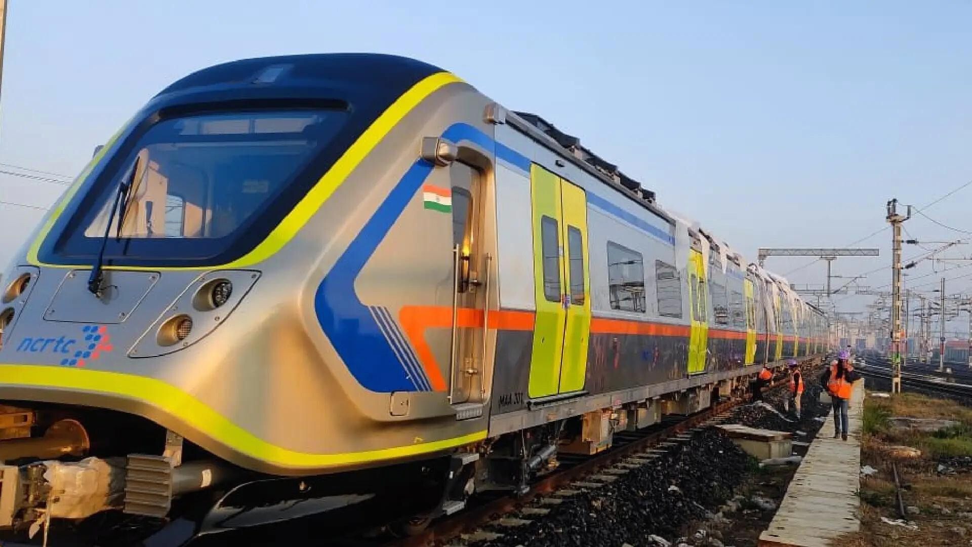
The Meerut Metro is an important urban transit project aimed at enhancing connectivity and addressing transportation needs in Meerut, Uttar Pradesh. Here’s a detailed look at the Meerut Metro:
History and Development
- Initiation: The Meerut Metro project was conceived to provide a modern, efficient public transportation system to tackle the city’s growing traffic congestion and mobility issues. The project was officially approved in 2019.
- Construction: Managed by the Meerut Metro Rail Corporation (MMRC), a joint venture between the Government of India and the Government of Uttar Pradesh, construction began in early 2021.
- Opening: The metro system is planned to commence operations in phases, with the initial sections expected to open by 2025.
Network and Lines
The Meerut Metro network is planned to consist of a single major line under Phase 1, with provisions for future extensions:
- Line 1 (RRTS – Regional Rapid Transit System):
- Route: The line will run from Sahibabad in Ghaziabad to Meerut South, covering key areas along the way.
- Length: Approximately 82.5 km (the entire RRTS corridor, which includes the Meerut Metro segment)
- Highlights: The line will connect Meerut with Ghaziabad and Delhi, providing a crucial link for commuters traveling between these cities. It is designed to integrate with other transport modes and improve connectivity across the region.
Expansion and Future Plans
- Phase 2 and Extensions: Future plans for the Meerut Metro include extending Line 1 to cover more areas within Meerut and potentially introducing new lines to enhance connectivity further. The expansions will aim to integrate with other regional transit systems and improve access to key locations.
Features and Technology
- Stations: Meerut Metro stations are designed with modern facilities, including escalators, elevators, automated ticket vending machines, and digital information displays. The stations will be built to ensure accessibility and passenger comfort.
- Trains: The metro trains will be air-conditioned and equipped with real-time information displays, safety systems, and comfortable seating to provide a smooth and efficient commuting experience.
- Ticketing: The metro will use a smart card system known as the “Meerut Metro Card,” allowing for convenient and efficient travel. Single-journey tickets and various passes will also be available.
Economic and Social Impact
- Traffic Decongestion: The Meerut Metro aims to alleviate traffic congestion by offering a reliable and efficient alternative to road transport. This will help in reducing travel times and improving overall urban mobility.
- Economic Growth: Improved connectivity is expected to boost economic activities, particularly in commercial areas along the metro route, and enhance access to various parts of Meerut and neighboring regions.
- Quality of Life: The metro system will contribute to a better quality of life by providing a modern, comfortable commuting option, reducing travel time, and improving accessibility across Meerut.
Safety and Efficiency
- Safety Measures: The Meerut Metro will be equipped with advanced safety features, including fire detection systems, CCTV surveillance, and emergency communication facilities to ensure passenger safety.
- Operational Efficiency: The metro system will adhere to high standards of punctuality and operational efficiency, following best practices in urban transit to provide reliable service for passengers.
Environmental Impact
- Eco-Friendly: The Meerut Metro is designed to be an environmentally friendly transportation option, aiming to reduce the carbon footprint associated with road transport. It supports sustainable urban mobility by decreasing traffic congestion and promoting public transport usage.
Conclusion
The Meerut Metro is set to significantly enhance the city’s public transportation infrastructure. With its planned network, modern amenities, and focus on efficiency, the metro will play a crucial role in improving urban mobility, supporting economic growth, and enhancing the overall commuting experience for Meerut residents. Its integration with other transport systems and commitment to environmental sustainability highlight its importance in shaping the future of transportation in Meerut and the surrounding region.
18. Patna Metro (PMRC)
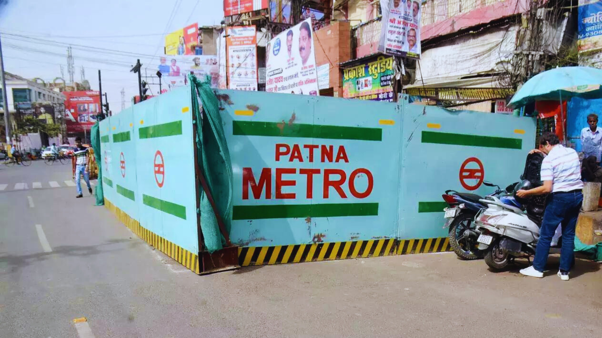
The Patna Metro is a transformative urban transit project aimed at improving transportation infrastructure and reducing traffic congestion in Patna, the capital city of Bihar, India. Here’s a detailed look at the Patna Metro:
History and Development
- Initiation: The concept of the Patna Metro was developed to address the growing transportation needs of the city and to provide a modern, efficient public transportation system. The project was approved in 2019.
- Construction: Managed by the Patna Metro Rail Corporation (PMRC), a joint venture between the Government of India and the Government of Bihar, construction began in early 2021.
- Opening: The initial sections of the Patna Metro are expected to be operational by 2025, with the full network planned to be completed in subsequent phases.
Network and Lines
The Patna Metro is designed to include a major line under Phase 1, with plans for future extensions:
Line 1 (North-South Corridor):
- Route: The line will run from Mithapur Bus Stand in the southern part of the city to Patna Junction in the north.
- Length: Approximately 30 km
- Highlights: Line 1 will connect key areas such as Mithapur, Rajendra Nagar, and Patna Junction, integrating major residential, commercial, and administrative zones. This corridor aims to significantly enhance connectivity and provide a reliable alternative to road transport.
Line 2 (East-West Corridor):
- Route: Planned to connect Patna’s eastern and western parts.
- Length: Approximately 17 km (under planning and future phases)
- Highlights: This line will connect areas like Danapur and Patna City, providing better access to important zones and integrating with Line 1 at key points.
Expansion and Future Plans
- Phase 2 and Extensions: Future phases and extensions are planned to cover additional parts of Patna and surrounding areas. This includes extending Line 1 and introducing new lines to further enhance connectivity and integrate with other modes of transport.
Features and Technology
- Stations: Patna Metro stations will be equipped with modern facilities such as escalators, elevators, automated ticket vending machines, and digital information boards. Stations are designed to ensure accessibility and comfort for all passengers.
- Trains: The metro trains will be air-conditioned and feature real-time information displays, safety systems, and comfortable seating. The design aims to provide a smooth and efficient commuting experience.
- Ticketing: The metro system will use a smart card system, known as the “Patna Metro Card,” for convenient and efficient travel. Single-journey tickets and various passes will also be available.
Economic and Social Impact
- Traffic Decongestion: The Patna Metro is expected to alleviate traffic congestion by providing a reliable and efficient alternative to road transport. This will help in reducing travel times and improving overall urban mobility.
- Economic Development: Improved connectivity is anticipated to boost economic activities in commercial areas along the metro route and enhance access to various parts of Patna.
- Quality of Life: The metro system aims to improve the quality of life by offering a modern, comfortable commuting option, reducing travel time, and improving accessibility across the city.
Safety and Efficiency
- Safety Measures: The Patna Metro will be equipped with advanced safety features, including fire detection systems, CCTV surveillance, and emergency communication facilities to ensure passenger safety.
- Operational Efficiency: The metro will adhere to high standards of punctuality and operational efficiency, following best practices in urban transit to provide reliable service for passengers.
Environmental Impact
- Eco-Friendly: The Patna Metro is designed to be an environmentally friendly transportation option, aiming to reduce the carbon footprint associated with road transport. It supports sustainable urban mobility by decreasing traffic congestion and promoting the use of public transport.
Conclusion
The Patna Metro represents a significant advancement in the city’s public transportation infrastructure. With its planned network, modern amenities, and focus on efficiency, the metro will play a crucial role in improving urban mobility, supporting economic growth, and enhancing the overall commuting experience for Patna residents. Its integration with other transport modes and commitment to environmental sustainability underscore its importance in shaping the future of transportation in Patna.

19. Surat Metro (GMRCL)
The Surat Metro is a major urban transit project designed to address transportation challenges and enhance mobility in Surat, Gujarat. Here’s a detailed overview of the Surat Metro:
History and Development
- Initiation: Surat, being one of Gujarat’s rapidly growing cities, needed a modern transit system to tackle increasing traffic congestion and support urban development. The Surat Metro project was initiated to provide an efficient and reliable public transportation system.
- Approval and Planning: The project was approved by the Government of India and the Government of Gujarat in 2019. Detailed planning and design phases followed, culminating in the start of construction in 2020.
- Construction: Managed by the Surat Metro Rail Corporation (SMRC), the construction involves both elevated and underground sections to cover key areas of the city.
Network and Lines
The Surat Metro is planned to consist of two primary corridors under Phase 1, with future extensions and additional lines in the pipeline:
Line 1 (North-South Corridor):
- Route: This line runs from Sarthana to Dream City, connecting important parts of Surat.
- Length: Approximately 21.6 km
- Highlights: Line 1 connects significant areas including the Surat Railway Station, Sarthana Nature Park, and major residential and commercial districts.
Line 2 (East-West Corridor):
- Route: The line extends from the Nanpura area in the east to the Bhestan area in the west.
- Length: Approximately 14.5 km
- Highlights: This corridor serves key commercial and residential zones, providing better connectivity across the city.
Expansion and Future Plans
- Phase 2: Future plans include extending the current lines and potentially introducing new corridors to cover additional areas of Surat and improve connectivity with surrounding regions.
- Further Integration: Expansion plans also involve integrating the metro with other transportation systems, including buses and railways, to create a comprehensive urban mobility solution.
Features and Technology
- Stations: Surat Metro stations are designed with modern facilities such as escalators, elevators, automated ticket vending machines, and digital information boards. Stations are built to ensure accessibility and comfort for all passengers.
- Trains: The metro trains will be air-conditioned and feature real-time information displays, safety systems, and comfortable seating. The trains are designed to provide a smooth and efficient commuting experience.
- Ticketing: The metro system will use a smart card system, known as the “Surat Metro Card,” for convenient and efficient travel. Single-journey tickets and various passes will also be available.
Economic and Social Impact
- Traffic Decongestion: The Surat Metro aims to alleviate traffic congestion by providing a reliable and efficient alternative to road transport. This will help in reducing travel times and improving overall urban mobility.
- Economic Growth: Improved connectivity is expected to boost economic activities, particularly in commercial areas along the metro route, and enhance access to various parts of Surat.
- Quality of Life: The metro system will contribute to a better quality of life by offering a modern, comfortable commuting option, reducing travel time, and improving accessibility across the city.
Safety and Efficiency
- Safety Measures: The Surat Metro will be equipped with advanced safety features, including fire detection systems, CCTV surveillance, and emergency communication facilities to ensure passenger safety.
- Operational Efficiency: The metro system will adhere to high standards of punctuality and operational efficiency, following best practices in urban transit to provide reliable service for passengers.
Environmental Impact
- Eco-Friendly: The Surat Metro is designed to be an environmentally friendly transportation option, aiming to reduce the carbon footprint associated with road transport. It supports sustainable urban mobility by decreasing traffic congestion and promoting public transport usage.
Conclusion
The Surat Metro is set to be a significant enhancement to Surat’s public transportation infrastructure. With its modern design, planned expansions, and focus on efficiency, the metro will play a crucial role in improving urban mobility, supporting economic growth, and enhancing the overall commuting experience for Surat residents. Its integration with other transport modes and commitment to environmental sustainability underscore its importance in shaping the future of transportation in Surat.
20. Bhubaneswar Metro (Government of Odisha)
The Bhubaneswar Metro is a significant urban transport project designed to improve public transportation and address the growing mobility needs of Bhubaneswar, the capital city of Odisha, India. Here’s an in-depth look at the Bhubaneswar Metro:
History and Development
- Initiation: As Bhubaneswar continues to grow rapidly, there has been a pressing need for a modern transportation system to address traffic congestion and enhance urban mobility. The idea of a metro system was conceived to provide a reliable and efficient public transport solution.
- Approval: The project received formal approval from the Government of India and the Government of Odisha in 2021.
- Construction: The Bhubaneswar Metro is being developed under the aegis of the Bhubaneswar Metro Rail Corporation (BMRC). The construction began in 2022 with an emphasis on both elevated and underground sections to cover key areas of the city.
Network and Lines
The Bhubaneswar Metro will feature a primary corridor under Phase 1, with plans for future extensions:
Line 1 (North-South Corridor):
- Route: The line will run from the northern part of the city at the Baramunda area to the southern end at the Khandagiri area.
- Length: Approximately 20.5 km
- Highlights: Line 1 will connect important locations including the Baramunda Bus Stand, the University area, and Khandagiri Caves. It is designed to integrate key commercial, educational, and residential areas, improving connectivity across the city.
Line 2 (East-West Corridor):
- Route: This line is planned to connect from the eastern part of the city to the western regions.
- Length: Approximately 16 km (under future planning)
- Highlights: Line 2 will cover significant areas and aim to provide better cross-city connectivity, integrating with Line 1 at key points to offer comprehensive coverage.
Expansion and Future Plans
- Phase 2 and Extensions: Future plans for the Bhubaneswar Metro include extending Line 1 and introducing new lines to cover more areas within Bhubaneswar and potentially connect to surrounding suburban areas. This expansion will focus on improving connectivity and integrating with other transport systems.
- Integration with Other Transport: The metro will be designed to integrate with existing and planned transport modes such as buses and regional rail services to create a seamless travel experience.
Features and Technology
- Stations: Bhubaneswar Metro stations will be equipped with modern amenities such as escalators, elevators, automated ticket vending machines, and digital information displays. Stations are planned to be accessible and comfortable for all passengers.
- Trains: The metro trains will be air-conditioned and feature real-time information displays, safety systems, and comfortable seating arrangements. They are designed to ensure a smooth and efficient commuting experience.
- Ticketing: The metro system will utilize a smart card system, known as the “Bhubaneswar Metro Card,” for easy and efficient travel. Various passes and single-journey tickets will also be available for passengers.
Economic and Social Impact
- Traffic Decongestion: The Bhubaneswar Metro aims to reduce traffic congestion by offering an efficient alternative to road transport, which will help in cutting down travel times and improving overall urban mobility.
- Economic Development: Enhanced connectivity is expected to boost economic activities in commercial areas along the metro route and improve access to various parts of Bhubaneswar.
- Quality of Life: The metro system is anticipated to enhance the quality of life by providing a modern, comfortable commuting option, reducing travel time, and improving accessibility across the city.
Safety and Efficiency
- Safety Measures: The Bhubaneswar Metro will be equipped with advanced safety features such as fire detection systems, CCTV surveillance, and emergency communication facilities to ensure passenger safety.
- Operational Efficiency: The metro system will follow high standards of punctuality and operational efficiency, adhering to best practices in urban transit to provide reliable service for passengers.
Environmental Impact
- Eco-Friendly: The Bhubaneswar Metro is designed to be an environmentally friendly transportation solution, aiming to reduce the carbon footprint associated with road transport. It supports sustainable urban mobility by decreasing traffic congestion and promoting public transport usage.
Conclusion
The Bhubaneswar Metro is set to be a transformative project for the city, bringing modern public transportation infrastructure to Bhubaneswar. With its planned network, advanced amenities, and focus on efficiency, the metro will play a crucial role in enhancing urban mobility, supporting economic growth, and improving the overall commuting experience for residents. Its commitment to integrating with other transport modes and supporting environmental sustainability highlights its importance in shaping the future of transportation in Bhubaneswar.
